KYRGYZSTAN DISTRICTS
- Territory Guide
- KYRGYZSTAN DISTRICTS
Create a map of Kyrgyzstan districts and unlock the ability to compare and contrast district progress like never before. By mapping out each district, you’ll gain a crystal-clear view of how different regions are performing in key areas. Whether you’re tracking sales performance, streamlining your logistics, or looking for ways to up your marketing strategies, a district-level map is an integral tool that allows you to visualize progress and identify where the gaps or opportunities lie.
Let’s add these administrative boundaries to your map now and see how fast it is to capture insights to drive strategic growth and ensure no district is left behind in your planning!
WHAT ARE KYRGYZSTAN DISTRICTS?
With the country’s seven regions divided into 44 districts, analyzing a district boundary map transforms static numbers into a dynamic visual. Suddenly, your strategies come alive! Successful brands leverage a district-level analysis to see crucial trends and connections that guide them with more informed, strategic decisions for more effective planning and action.
When you build a Kyrgyzstan district map, you’ll begin to uncover patterns across each district that are key to your organizational planning. These patterns reveal important insights that help you understand the relationships between districts—insights you might otherwise overlook.
ADD KYRGYZSTAN DISTRICTS
Ignite a remarkable transformation in your business analysis and strategy by adding Kyrgyzstan districts to your map now! Unlike broader territories such as regions, districts offer a smaller, more focused view, which is why most brands prioritize district-level analysis. This granular approach uncovers insights that broader analysis might miss, allowing you to pinpoint challenges and opportunities with greater precision.
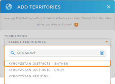
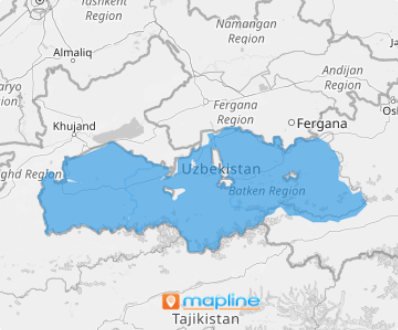
In a few seconds, add a new territory from Mapline’s repository when you click on the ADD button on the left side of your map. Then, type KYRGTYZSTAN in the search bar and select KYRGYZSTAN DISTRICTS. The district boundaries are available in Batken and Chuy regions.
Now that you have the right territory, let’s learn more about how to add colors to make smarter, more targeted decisions that drive impactful results for your business.


Pro Tip: Looking to access different regional boundaries on your map? Look no further! Mapline’s repository of worldwide territory boundaries is your one-stop access to incorporate different regional boundaries into your map including the Kyrgyzstan regions and districts.
CHOOSE DISTRICT COLORS
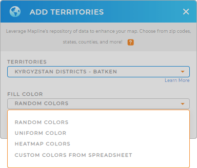
Apply territory colors to drill down into your district-level data and watch how your map sparks more insights that will help you with informed decision-making. Territory colors are essential for enhancing your map’s visual appeal and simplifying complex data. By applying various color styles—be it random colors, uniform shades, heat maps, or personalized hues—you can effectively spotlight key information. This not only makes the data more engaging but also facilitates easier interpretation, allowing you to draw insights quickly and accurately.
With the right color styling, be empowered to make informed decisions that can significantly impact your strategic direction.

GET NEW TERRITORY INSIGHTS
Now, work with these powerful capabilities on your map of Kyrgyzstan districts and get your analytics in full swing!
- Draw custom territories tailored to specific requirements
- Understand each district’s performance with detailed reports
- Leverage Mapline Data to enhance your territory insights


