LIECHTENSTEIN MUNICIPALITIES
- Territory Guide
- LIECHTENSTEIN MUNICIPALITIES
Turbocharge your territory analysis with a map of Liechtenstein municipalities. Mapping how insights flow within each municipality boundary can supercharge your strategy, paving the way for your next big business move. This insight is particularly crucial when searching for the optimal location for business expansion, allowing you to make informed decisions that drive success.
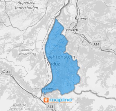
Waste no time creating a Liechtenstein municipality map in just seconds! With this municipality map at your fingertips, effortlessly map out connections within each municipality boundary and watch powerful insights come to life!
WHAT ARE LIECHTENSTEIN MUNICIPALITIES?
Liechtenstein is a doubly landlocked microstate nestled in the Central European Alps, bordered by Austria and Switzerland. The country is divided into 11 municipalities, each contributing to its unique character. Successful brands are turning to a Liechtenstein municipality map for good reason: to make informed decisions based on valuable insights. As insights pour in, patterns and relationships between boundaries start to reveal themselves, unlocking new pathways for growth. Ultimately, this leads to impactful data discovery, empowering organizations to leverage their findings for strategic growth and enhanced decision-making.
Ready when you are, let’s add these administrative divisions to your map now.
ADD LIECHTENSTEIN MUNICIPALITIES
Add municipality boundaries to your map to gain precise geographic context. The location insights you gather will significantly enhance your decision-making process, enabling you to craft targeted strategies to improve your business operations. This level of clarity and understanding is nothing short of fantastic!
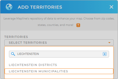
To add a new territory from Mapline’s repository, type LIECHTENSTEIN to your search bar and select LIECHTENSTEIN MUNICIPALITIES to add to your map.
How easy can it get? Now, let’s move on to your style settings.


Pro Tip: Seamlessly incorporate territories from different countries into your map including Liechtenstein districts and municipalities to advance your business development goals. Explore different regions from Mapline’s extensive repository of territory boundaries to monitor your business progress.
CHOOSE MUNICIPALITY COLORS
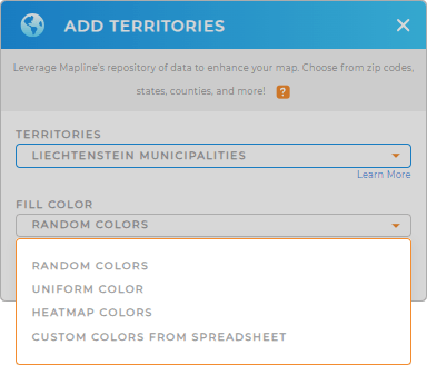
Now, color-code your municipality map to reveal key insights at a glance. Use distinct color styles to create an exceptional visual representation that enhances data visualization and analytics. This allows you to capture hyper-focused insights that can drive more informed decision-making.
Choose your desired color styling from the options – heat map, uniform color, random colors, or custom colors. Then click OK once you’ve configured your settings.
Now that you have just created a map of Liechtenstein municipalities, start digging into those valuable insights to propel your business forward!

GET NEW TERRITORY INSIGHTS
Be better acquainted with other mapping tools such as
- Add center of minimum distance to your map to help reduce mileage and pinpoint travel challenges,
- Access territory reports to get insights specific to a certain radius area
- Customize your pins to convey crucial data information,


