MALAWI REGIONS
- Territory Guide
- MALAWI REGIONS
Transform your map of Malawi regions into an analytic powerhouse that captures invaluable insights to drive continuous business growth! Many brands leverage this territory map for strategic planning, particularly when expanding their presence from one region to another. With this powerful tool, you can easily identify patterns, assess risks, and uncover opportunities that may have remained hidden without this level of detail.
Embrace the potential of your map and watch your business thrive! Let’s set up this territory map for you now. We only need a minute or less to start your region-level mapping!
WHAT ARE MALAWI REGIONS?
Malawi, a landlocked country in southeastern Africa, is renowned for its breathtaking highlands and expansive lakes. It is divided into three distinct regions – Northern, Central, and Southern. Each region presents a unique opportunity for analysis. Integrating a region map with your data helps uncover valuable insights that lead to better decision-making. Analyzing perspectives at the regional level allows you to prepare for unforeseen events and adapt your strategies accordingly.
Embrace the power of mapping to make a meaningful impact!
ADD MALAWI REGIONS
Unleash the power of hidden connections by mapping insights across Malawi’s regions. This approach allows you to refine your strategic planning, especially when looking to expand your brand presence from one region to another. Let your map guide you to informed decisions that propel your business forward!
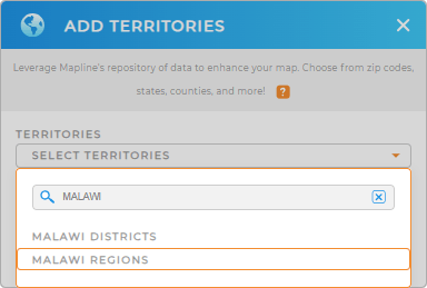
To set up your region territory map, first, add a new territory from Mapline’s repository. Type MALAWI in the search bar and select MALAWI REGIONS.
How quick is that?


Pro Tip: Tap into Mapline’s extensive list of territory boundaries to seamlessly add Malawi territories including Malawi districts and regions to your maps in seconds!
CHOOSE REGION COLORS
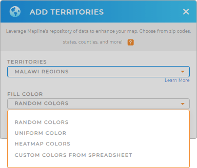
Gear up and prepare to unlock the full potential of your data by applying colors! Colors are essential for identifying patterns, assessing risks, and revealing opportunities that may have previously gone unnoticed. By strategically leveraging color styles, you can enhance your data visualization and make informed decisions that drive success.
Choose the type of colors you want to apply in your analysis. When you’re done, click OK.
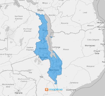
And you’re done! You’ve just created a map of Malawi regions in under a minute!

GET NEW TERRITORY INSIGHTS
Now, here are some powerful capabilities to help level up your data analysis on a region territory map:
- Create instant customer sales map to keep tabs on your sales activities 24/7
- Generate geo-intelligent sales routes in just a few clicks
- Run advanced calculations to sharpen on the precise insights you need


