MALI REGIONS
- Territory Guide
- MALI REGIONS
Visualizing your data on a map of Mali regions helps you pinpoint key factors that impact your business. A detailed region-level analysis is more than just viewing your data connections from afar. It provides the precise insights you need to succeed. With this powerful analytical tool, you can assign territories with pinpoint accuracy, focus on your target markets, and streamline your business operations.
Transform your data and territory analysis as you create a map of Mali regions in under a minute! Brace yourself and watch how your region territory map turns complex data into actionable insights.
WHAT ARE MALI REGIONS?
Mali is the 8th largest country in Africa, comprising 8 regions and 1 capital district. They are the key administrative pillars that shape the nation. Now, imagine elevating your data by layering it onto a territory map. This powerful visualization isn’t just a neat trick—it’s your gateway to uncovering game-changing insights through the dynamic interplay of data and regional boundaries. Combining these layers empowers you to transform complex information into clear, actionable intelligence that drives impactful decisions.
Dive into this approach, and watch your data analytics transform into a powerhouse of strategic insight!
ADD MALI REGIONS
You can add Mali’s regions to your map in just seconds—so quick, you’ll barely notice you’re done! This simple step is key to unlocking new opportunities, boosting operational efficiency, and making smarter strategic decisions.
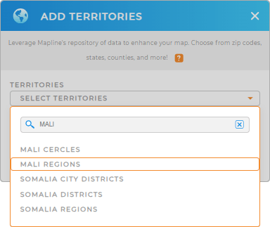
To streamline the process, start by adding a new territory from Mapline’s repository. In the search bar, type MALI and choose to add MALI REGIONS.
You’re almost done. Let’s just add some colors to your map.


Pro Tip: Easily add Mali’s territory boundaries, including Mali cercles and regions, with Mapline’s extensive list of global territory boundaries. With access to hundreds of territories worldwide, you can unlock powerful new insights that drive smarter decisions and strategic growth.
CHOOSE REGION COLORS
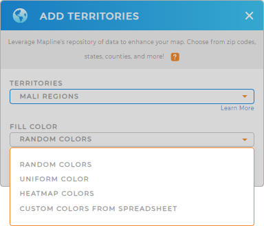
Maximize the potential of your region map by adding distinct territory colors. Colors enhance the way you interpret data, making it easier to spot trends and patterns at a glance. By incorporating colors into your territory map, you spark deeper insights that fuel more effective strategic planning and decision-making.
Mapline provides exceptional color styles to choose from – random colors, heat map colors, custom colors, or uniform color – all designed to meet your type of analysis. Select the best color styling that matches your analysis, then click OK.
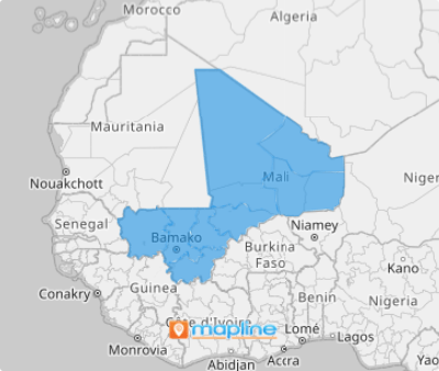
Now, that wraps up your map of Mali regions.

GET NEW TERRITORY INSIGHTS
Streamline your analytics by leveraging these powerful capabilities on your region territory map:
- Get a clear view of your job locations to cover your service area and streamline your schedules
- Configure Mapline data for competitor analysis
- Make your data stories come alive with customized maps


