MALTA ISLANDS
- Territory Guide
- MALTA ISLANDS
Add Malta islands to your map, and get ready to unlock a whole new realm of insights! By incorporating island-level analysis into your strategy, you’re opening the door to a treasure trove of valuable information. This detailed approach can uncover hidden opportunities, optimize your operations, and enhance your marketing efforts for maximum impact. Imagine targeting your strategies with pinpoint accuracy and propelling your business growth like never before!
Ready to elevate your strategic planning? Let’s dive into adding these administrative divisions to your map and discover how this unique perspective can enhance your insights, drive informed decision-making, and unlock new growth opportunities for your business.
WHAT ARE MALTA ISLANDS?
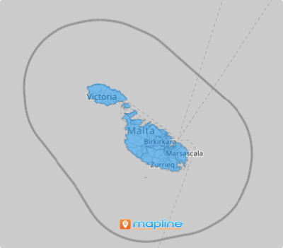
Malta is a small yet strategically significant island nation situated in the heart of the Mediterranean Sea. This compact archipelago boasts its three major islands – Malta, Comino, and Gozo, which are in prime locations, making them the crossroads of cultures and an enduring Mediterranean hub.
Successful brands leverage detailed maps of the Maltese islands to inform and refine their strategies, gaining a clear understanding of Malta’s distinct markets. By visualizing data within these island boundaries, you can easily pinpoint high-impact areas that drive business success, uncovering local insights that shape effective operations and growth initiatives.
Let’s get these island boundaries added to your map very quickly.
ADD MALTA ISLANDS
Visualize the impact of local trends and patterns on your brand like never before! With the powerful visualization offered by your island territory map, you can easily grasp insights without the hassle of sleepless nights spent sifting through endless rows and columns of spreadsheets!
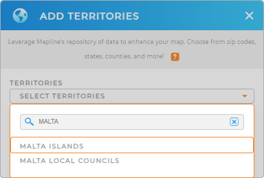
Let’s dive into adding a new territory from Mapline’s repository. Type MALTA in the search bar, and then select MALTA ISLANDS to add to your map.
Wow! How quick is that?


Pro Tip: Custom maps featuring Malta islands and Malta local councils, created using Mapline’s Territory Repository, offer a detailed and visual representation of your operational landscape.
CHOOSE ISLAND COLORS
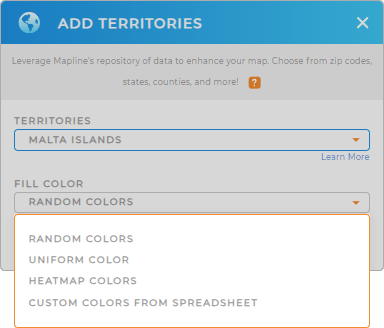
Next, let’s dive into your data visually and empower your decision-making process with clarity and confidence by color-coding your territory map. Let’s say you’re in the tourism industry. You can leverage a color-coded map to understand the trends and develop strategies to reach out to different markets whether it’s peak tourist times or off-peak seasons. You can opt for heat map colors to take advantage of their clear color gradient, making it easy to identify patterns and opportunities at a glance!
There are color styles to choose from. Once you have configured your color settings, click OK. Now, start analyzing your data on your map of Malta islands to capture more valuable insights for informed decision-making.

GET NEW TERRITORY INSIGHTS
Leverage these advanced capabilities to unlock hidden insights from your map:
- Run advanced data calculations to identify a goldmine of insights about your business
- Add a new chart to display the exact information you need
- Generate intelligent sales forecasts with market demogrpahics


