POLAND PROVINCES
- Territory Guide
- POLAND PROVINCES
A map of Poland provinces is a powerful visualization tool that offers valuable business insights. Many brands use these maps for targeted advertising, identifying regions with higher potential for specific products or services. It’s also a key tool for customer segmentation, allowing businesses to categorize customers based on geographic data and tailor marketing messages accordingly. This approach helps optimize campaigns, improve engagement, and drive sales by reaching the right audience with the right message in the right location.
Add these administrative boundaries to your map in just a few clicks and dive into data analysis right away.
WHAT ARE POLAND PROVINCES?
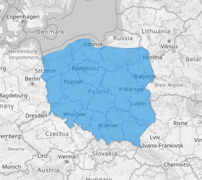
Poland, nestled in the heart of Central Europe, is divided into 16 vibrant provinces known as voivodeships. Each voivodeship operates under a shared authority system to ensure that these legally recognized I-tier units remain dynamic and well-administered.
Integrating province boundaries into your map is a transformative way to unlock powerful insights into market dynamics, logistics flows, and regional trends. Visualizing Poland’s provinces empowers your business to seize emerging opportunities with agility. With this feature, you can fine-tune operations and elevate your data analytics to a whole new level of precision and effectiveness.
ADD POLAND PROVINCES
A map with clearly defined geographic boundaries serves as a powerful visualization tool, offering valuable insights for a range of business applications. Whether you’re optimizing logistics, targeting specific customer segments, or evaluating growth opportunities, a well-defined map provides clarity and direction for smarter business moves.
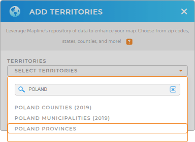
Add a new territory from Mapline’s repository. Type POLAND in the search bar and select POLAND PROVINCES. It’s a quick and easy step that unlocks powerful insights, keeping your business ahead of the curve and driving success at full speed!


Pro Tip: Mapline’s worldwide territory repository lets you add Poland territories including Poland counties, Poland municipalities, and provinces, allowing you to optimize your business operations in the country seamlessly.
CHOOSE PROVINCE COLORS
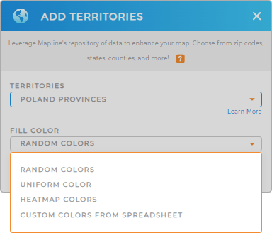
Get ready to drive more insights as you apply territory colors. Colors boost your ability to make strategic decisions with clear, color-coded data. No more wasting hours or days on analysis—now you can pinpoint key factors in your territories in just minutes or seconds, making your decision-making faster, smarter, and more efficient!
Just choose the best color styles for your analysis. Lastly, click OK and you can start reaping valuable insights from your map of Poland provinces.

GET NEW TERRITORY INSIGHTS
Now, fast-track your analysis using these capabilities:
- Streamline your bid management process to reduce errors and enhance your professional image
- Discover how center points can sharpen your location strategy
- Showcase all your visual insights in one dynamic, easy-to-navigate hub


