MAURITIUS DISTRICTS
- Territory Guide
- MAURITIUS DISTRICTS
Dive into advanced analytics by mapping your insights across Mauritius districts. A district-level analysis helps you uncover critical insights and ideas, connecting them directly to actionable business strategies. With clearly defined district boundaries, you can easily capture insights that might otherwise go unnoticed, empowering you to make informed, impactful decisions that drive your business forward.
Buckle up because you’re about to add these administrative divisions to your map in just under a minute!
WHAT ARE MAURITIUS DISTRICTS?
Mauritius is an island country located in the Indian Ocean. The island is divided into nine districts, serving as the country’s second-order administrative divisions. A district territory map transforms territory analysis into a swift, streamlined process, unlocking clarity and efficiency.
Leverage your Mauritius district map to make informed decisions that drive growth. By utilizing district mapping, you can enhance your decision-making process to attract more investments, showcasing potential opportunities and strategic advantages to stakeholders.
ADD MAURITIUS DISTRICTS
Step up your analysis as you make your map of Mauritius districts a vital instrument to your analytical toolkit. With this precise level of analysis, you can revolutionize your approach to business expansion. By understanding the unique geographic and market dynamics at play, you can identify strategic opportunities, optimize resource allocation, and make data-driven decisions that propel growth and maximize impact.
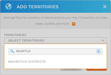
It’s so easy to add a new territory from Mapline’s repository. To add the right territory, type MAURITIUS in the search bar to trim down the selections and click to add MAURITIUS DISTRICTS to your map.
One last step to go and you’re on your way to analyze your data on a district-level map.


Pro Tip: Easily add Mauritius districts by accessing Mapline’s extensive list of territory boundaries. With hundreds of territories from around the globe at your fingertips, Mapline empowers you to unlock powerful new insights and drive smarter business decisions.
CHOOSE DISTRICT COLORS
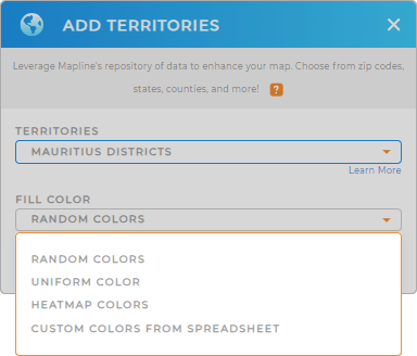
Now is the time to apply territory colors! Colors empower you to uncover patterns in your territories and data that may have been hidden in your spreadsheets. Transform your district boundaries into a powerful visualization tool that allows you to capture insights, enabling informed decisions that drive your business forward.
Select the best type of colors applied to your territory. Once you have configured your color settings, click OK.
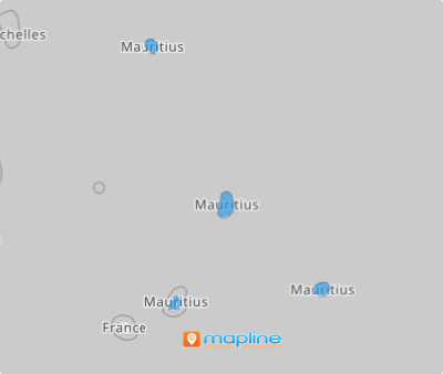
p>Now, you’ve just enhanced the power of your map of Mauritius districts!
GET NEW TERRITORY INSIGHTS
Continue to grab more valuable insights in your data analysis when you incorporate these powerful capabilities:
- Visualize trends and patterns in your data
- Display data summary of each district boundary in a Folder Report
- Strategize marketing campaigns to meet hyper- local needs


