THE NETHERLANDS COUNTRIES
- Territory Guide
- THE NETHERLANDS COUNTRIES
Turn your map of The Netherlands counties into an analytic powerhouse that drives unstoppable business growth. It’s like having a supercharged tool in your arsenal—brands use these territory maps for strategic planning, especially when expanding their presence from one state to the next. With this level of detail, you can spot patterns, calculate risks, and uncover hidden opportunities that would otherwise go unnoticed.
Harness this power for your business success! Let’s set up this territory map for you in under a minute to start your country-level mapping!
WHAT ARE THE NETHERLANDS COUNTRIES?
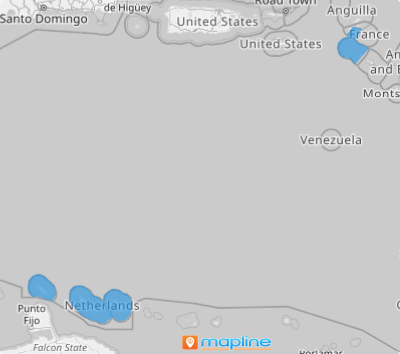
The Netherlands — also known as Holland —in all its glory, is nestled in Northwestern Europe. With its four constituent countries —Aruba, Curacao, the Netherlands, and Sint Maarten—this country is a tourist magnet, brimming with potential. A map that outlines these borders isn’t just a set of lines; it’s your lens into the strengths and opportunities within the tourism industry. By crafting a detailed territory map, you’re equipping your organization with the tools needed for explosive business growth.
Dive into this map of constituent countries, and you’ll unlock crucial insights for competitor analysis, market research, and sales improvements.
ADD THE NETHERLANDS COUNTRIES
Add the constituent countries of The Netherlands to your map and turn it into an insight-driven powerhouse—uncover trends, seize opportunities, and fuel smarter decisions. Learn more about data connections when presented on a map of The Netherlands countries.
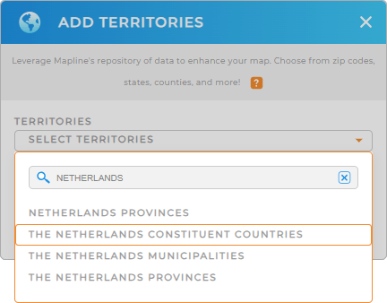
Got 60 seconds or less? Then let’s go ahead and add a new territory from Mapline’s repository! Just type THE NETHERLANDS in the search bar and select THE NETHERLANDS CONSTITUENT COUNTRIES to add to your map.
It’s that easy!


Pro Tip: Get access to Mapline’s extensive list of territory boundaries to seamlessly add The Netherlands territories including The Netherlands constituent countries, The Netherlands provinces, and The Netherlands municipalities to your map in seconds!
CHOOSE COUNTRY COLORS
Suppose you’re in the logistics business and you’re looking for the most efficient way to optimize your routes. By adding colors attached to your data, you can glean location-based insights that allow you to build cost-effective delivery planning to optimize your delivery schedules and boost your bottom line significantly!
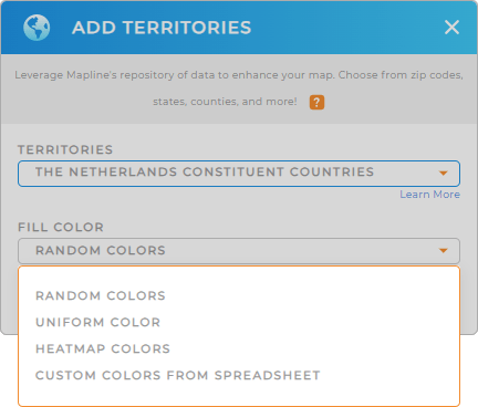
Choose the color styling you want to apply in your analysis. When you’re done, click OK.
And you’re done! Enjoy your enhanced analysis and insights on a map of The Netherlands countries!

GET NEW TERRITORY INSIGHTS
Now, here are some powerful capabilities to level up your analysis on a map of The Netherlands countries:
- Keep tabs on your sales activities 24/7 when you create instant customer sales map for increased efficiency and reduced travel time
- Generate geo-intelligent sales routes in seconds
- Run advanced calculations to hone in on the precise insights you need


