
Discover Spatial Stories by Mapping Parishes and Municipalities of Bermuda
Territory Maps to Understand Data Better
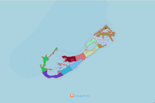
As a British Overseas Territory with a total area of 53.3 square kilometers, one can learn more about this place by mapping parishes and municipalities of Bermuda. When you think of Bermuda, the first thing that comes to mind is that it is a popular destination in North America. Sure it is! However, there is so much more than you can explore. Mapline helps in giving you the perfect mapping tool to explore the island. The first stop is to understand Bermuda parishes and municipalities. By mapping these boundaries, you will be able to dig deeper than the geographical nature of the parishes and municipalities.
As part of Mapline’s aim to provide powerful data visualization, it continues to design mapping tools which are instrumental to make data and spatial analysis fast and feasible.
Bring Your Data to Life by Mapping Territory Boundaries
Create a map of parishes and municipalities of Bermuda. Discover first hand the spatial relationships shown on the map.
- Create a Mapline account and login.
- Click the orange “Add New Items” button.
- Select “New Map” on the drop down arrow.
- Give your map a name and click “OK.”
- Click the “Add” button from the left sidebar.
- Select the “Territories” option.
- Click “From Mapline’s Repository.”
- From the “Territories” select “Bermuda Parishes and Municipalities.” You can also enter that on the search bar.
- Select how you want your boundaries to be colored in “Fill Color” (Random Colors, Uniform Color, Dynamic heat map colors, or Custom colors from spreadsheet).
- Click “OK.”
A map of Bermuda parishes and municipalities lets you understand not only your dream destination but also your dream goal to understand the country better. Sign up to start creating a map now.