
Mapping USA Supervisorial Districts in San Francisco
A Map of Supervisorial District – The Best Way to Understand Each District
Mapping San Francisco Supervisorial Districts is a great tool to run the city. There are 11 Supervisorial Districts in San Francisco, California, USA. The Board of Supervisors takes care in supervising the districts. In addition, different departments and agencies also help monitor each district. As a result, there may be some challenges when it comes to addressing issues or solving problems especially if the information is not coordinated accordingly. What can help solve these problems? A map of San Francisco Supervisorial Districts! How?
Mapline provides a territory boundary overlay of the supervisorial districts in San Francisco. When mapped, a clear visualization of each district will be shown. As a result, new insights and patterns may be understood. In the end, the map gives a correct focus on what to prioritize.
Not only does it give an in-depth district-level analysis. Rather, a map with an overlay boundary provides new ideas for project planning. In this way, agencies can work well with each other to attain specific goals.
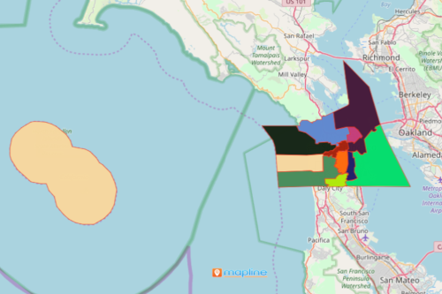
Mapping USA Supervisorial Districts (San Francisco, CA)
Here are the 10 easy steps to get you started:
- Create a Mapline account and login.
- Click the orange “Add New Items” button.
- Select “New Map” on the drop down arrow.
- Give your map a name and click “OK.”
- Click the “Add” button from the left sidebar.
- Select the “Territories” option.
- Click “From Mapline’s Repository.”
- From the “Territories” select “U.S. Supervisorial Districts – CA – San Francisco.” You can also enter that on the search bar.
- Select how you want your boundaries to be colored in “Fill Color” (Random Colors, Uniform Color, Dynamic heat map colors, or Custom colors from spreadsheet).
- Click “OK.”
Moreover, inter-agency tasks can be streamlined by embedding a map to your website. Mapping at a supervisorial district level will definitely provide key points to address issues fast. Sign up now to begin mapping!