PANAMA TOWNSHIPS
- Territory Guide
- PANAMA TOWNSHIPS
Create a map of Panama townships to speed up your analysis! Focusing on the granular level of municipalities allows you to tailor your strategies and meet the specific needs of your customers. Many brands use this territory map as an integral part of their analytics for targeted marketing, resource allocation, and strategic planning. Add Panama township boundaries to your map and uncover a treasure trove of location insights.
Let’s speed through adding township boundaries to your map and level-up your analytics in just a few moments!
WHAT ARE PANAMA TOWNSHIPS?
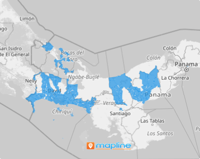
In Panama, the smallest slices of administrative pie are known as corregimientos, or townships. With a whopping 693 townships, plotting out a clear business strategy without a map can feel like navigating a labyrinth blindfolded. By mapping out each township, the fog lifts, revealing the narrative woven by the unique geographic and market dynamics. Spot those goldmine areas, plot the most effective sales routes, and deploy your sales force with laser focus.
With precise township boundaries on your map, you’re not just reacting; you’re two steps ahead, optimizing areas that need a boost and capitalizing on those that are already winning. That’s the dynamic edge you get with a map of Panama townships. Ready to dive in? Let’s do this!
ADD PANAMA TOWNSHIPS
Transform your business strategies with clear, actionable insights into regional performance. A map of Panama townships is a powerful visual that helps you drive informed decisions and optimize operations.
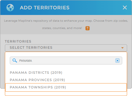
First, add a new territory from Mapline’s repository, type PANAMA into the search bar, and select PANAMA TOWNSHIPS.
Now, let’s quickly customize your territories for lightning-fast analytics.


Pro Tip: Mapline’s extensive list of territory boundaries enables you to add other countries’ regions to your map in more detailed data and territory analyses. Stay ahead of the curve by leveraging these territories including Panama districts, Panama provinces, and Panama townships into your map for enhanced analysis!
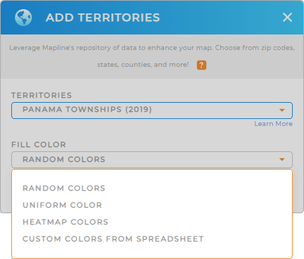
CHOOSE TOWNSHIP COLORS
Draw the deepest insights from your territory map as you add colors. When colors are applied to territories, it significantly improves clarity. Quickly grasp complex data through clear, color-coded visuals!
Choose your desired color styling . By thoughtfully selecting and applying these color styles, you can enhance your data and territory analysis, making it more intuitive, informative, and impactful.
Click OK, and your map of Panama townships is now ready to be used.

GET NEW TERRITORY INSIGHTS
Get more actionable insights from your territory map when you apply adding these capabilities to your analysis:
- Make your map pin convey crucial information
- Generate center points from your existing map pins
- Get insights specific to a coverage area on your map


