PAPUA NEW GUINEA PROVINCES
- Territory Guide
- PAPUA NEW GUINEA PROVINCES
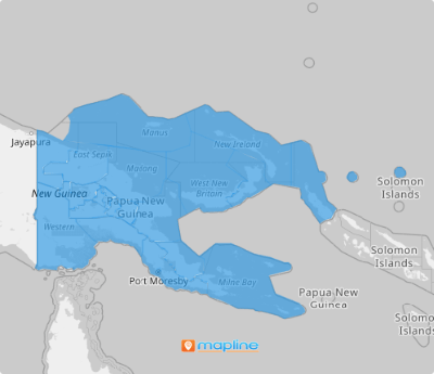
Stay one step ahead of the competition by analyzing key insights on a map of Papua New Guinea’s provinces. With the broader scope that province boundaries provide, you can easily see how your business operates within each region. A province map offers a powerful visualization tool that enables you to quickly and fully grasp the narrative behind your data. This deeper understanding allows you to make informed decisions and stay ahead in the competitive landscape.
Learn how to add Papua New Guinea provinces to your map in just a few seconds to start generating actionable insights to help you craft business strategies with confidence and precision!
WHAT ARE PAPUA NEW GUINEA PROVINCES?
Papua New Guinea, the world’s largest island country, is nestled comfortably in the Oceania continent. The country is divided into 20 provinces, along with the National Capital District of Port Moresby and the Autonomous Region of Bougainville, serving as its first-level administrative divisions. The most recent additions to these divisions are the provinces of Hela and Jiwaka, which were officially established on May 17, 2012.
Elevate your A-game in analytics as you dive deeper and learn the strengths of each province, resulting in enhanced business strategy development. There are only two easy steps to follow. Let’s start now!
ADD PAPUA NEW GUINEA PROVINCES
Start assessing factors that affect your business as you learn to create this territory map in a flash! Imagine having to identify high-potential markets, tailor marketing campaigns, and optimize resource allocation in just a few minutes – all because of the clearly defined boundaries of Papua New Guinea provinces to your map!
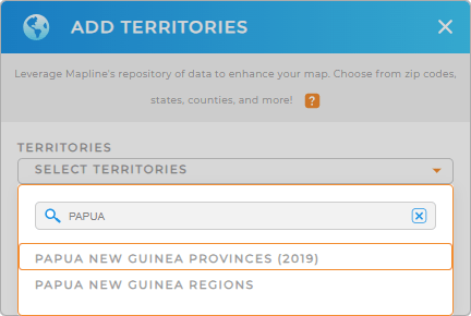
Adding a new territory from Mapline’s repository is so easy you can do it in a few clicks! In the search bar, type PAPUA NEW GUINEA then click to add PAPUA NEW GUINEA PROVINCES.
We told you that was easy!


Pro Tip: Access Mapline’s worldwide repository of territory boundaries to add international boundaries to your map including Papua New Guinea regions and provinces. This enables you to analyze key metrics and gain new ideas to chart territory plans successfully.
CHOOSE PROVINCE COLORS
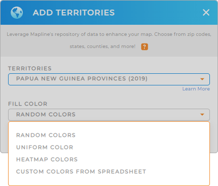
Now that you’ve selected the right territory, it’s time to apply a fill color. Colors are effective visualization techniques to differentiate between provinces. They are also exceptional in bringing out more insights as you identify spatial patterns, trends, or concentrations within each province.
To color-code your territory, choose from Mapline’s special types of color styling you can choose from – random colors, unified color, heat map, and custom colors. After configuring your color setting, click OK and you’re done with the process.

GET NEW TERRITORY INSIGHTS
Course through your strategies as you incorporate these capabilities into your data and territory analyses:
- Set up an automated trip planning system in just a few clicks
- Create location-driven marketing campaigns that really resonates with your customers
- Customize your map pins for quick identification


