PERU PROVINCES
- Territory Guide
- PERU PROVINCES
Elevate your marketing efforts beyond mere expectations as you leverage a detailed map of Peru provinces to your analysis. By visualizing province boundaries, you can understand the unique social and economic characteristics essential to each province. Since province boundaries have a larger scope, most brands leverage a province-level analysis to help them unveil marketing campaigns to widen their brand presence.
In less than a minute, you can create a province map here in Mapline. It’s designed that way so you can start uncovering fresh insights and sculpt effective strategies that target specific demographics, driving customer engagement, and delivering results that set your business miles apart from the competition.
WHAT ARE PERU PROVINCES?
Peru’s provinces represent the second level of the country’s administrative divisions, encompassing 196 provinces organized into 25 regions. The notable exception is Lima Province, which stands apart. This structure averages seven provinces per region, creating a wealth of data ripe for analysis.
Delve into this geographic framework and unlock valuable insights that can significantly enhance your strategic planning and decision-making. Each province possesses distinct characteristics that can inform your marketing and operational strategies. Align your approach with the unique needs of each of your target markets to successfully position your brand in a competitive landscape. Embrace this opportunity to drive your business forward with informed, strategic choices!
ADD PERU PROVINCES
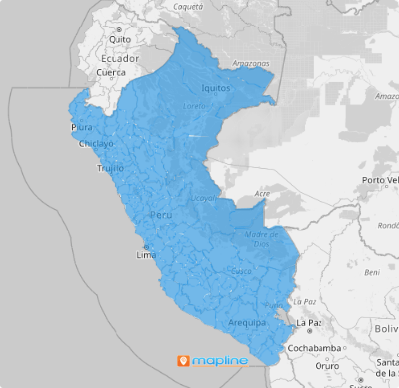
Make your map of Peru provinces a game-changer in your analysis! Create a powerful visualization that allows you to see geographic trends and patterns to refine your business performance. Analyze different business strategies on a province territory map to identify key insights related to market penetration. That includes identifying provinces with the highest sales potential vs underserved. The valuable insights can guide your strategies for expanding into new markets.
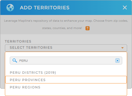
Add a new territory from Mapline’s repository to choose the right territory to add to your map. Be sure to use the search bar to type PERU and select PERU PROVINCES.
One last step and we’re good to go.


Pro Tip: Leverage Mapline’s Territory Repository to rev up your analysis. Equip your strategies with accurate boundaries including Peru provinces, Peru regions, and Peru districts, to gain sharper insights and be more informed to craft strategies more effectively.
CHOOSE PROVINCE COLORS
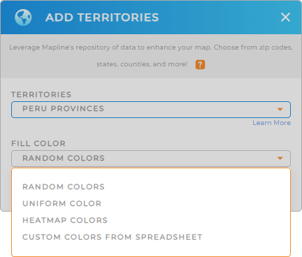
The last step is to apply territory colors. Colors are important in data visualization, enhancing clarity and insight. As you analyze your data, the visual clarity provided by color-coded distinctions will empower you to make informed decisions. This will enhance your ability to optimize sales strategies and allocate resources effectively. Embrace this visual insight to drive your business success!
From the selections, choose the type of colors your want to apply. Then click OK to wrap up and start analyzing your data on your map of Peru provinces.

GET NEW TERRITORY INSIGHTS
But that’s not all! Try applying these capabilities to help you dig deeper into your territory analysis:
- Implement distinct pin styles to identify areas of potential risk or concern
- Merge territories to define regions that align with your growth strategy
- Access folder reports to delve deeper into the data


