PHILADELPHIA POLITICAL WARDS
- Territory Guide
- PHILADELPHIA POLITICAL WARDS
A map of Philadelphia wards are commonly used for election purposes. But there is so much more to see! With Mapline’s precise territory boundaries of every ward, you’ll get to identify hidden challenges and discover new opportunities!
Fuel your location analytics by overlaying Philadelphia ward boundaries to your map. Here’s the ideal way to create a map of Philadelphia wards:
WHAT ARE PHILADELPHIA POLITICAL WARDS?
In Philadelphia, wards are significant political and administrative divisions that help structure local governance and community representation. Established in 1682, Philadelphia’s 66 wards each serve as distinct neighborhoods within the city, providing a foundation for organizing voting precincts and ensuring fair representation. Each ward plays an essential role in local elections, community initiatives, and constituent services, forming a backbone for effective civic engagement across the city.
Mapline allows you to map Philadelphia’s wards with ease, enabling data-driven analysis and localized insights. As additional ward territories become available, Mapline will further expand its resources, empowering you to visualize and work with detailed political boundaries in new ways.
ADD WARDS TO MAP
Efficiently assign territories to your sales or area managers. Adding Philadelphia wards to your map makes it easier to communicate with your managers for territory alignment. This way, every team member – Area Managers, drivers, sales representatives, and others, will be provided with the correct information at the earliest possible time.
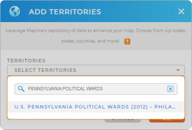
And the better part is that you can add a new territory from Mapline’s Repository in just less than a minute! To add Philadelphia ward boundaries, type in PHILADELPHIA WARDS in the search bar to get a quick result.


Pro Tip: Mapline’s Repository has special boundaries in Philadelphia, PA. They are obtained from the U.S. Census Bureau. Aside from political wards, you can also take advantage of overlaying other special boundaries such as Philadelphia ward divisions and Philadelphia council districts.
CHOOSE WARD COLORS
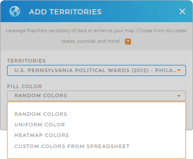
Territories presented in colors create a powerful visual to ignite ideas that can be used for decision making. So add more value to your map as you take a few moments of your time to add the best color style for your ward territories.
Now, you can make the ward boundaries come alive by assigning color styles. Play around with these options and get the best color style for your territories!
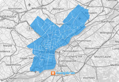
Click OK and your map is ready to view!

GET NEW TERRITORY INSIGHTS
Make the best use of your map with Philadelphia wards to:
- Ensure that your team stays in compliance with onsite tracking
- Customize dashboards and reports
- Adjust the data on your charts quickly to reflect exactly what you need to see


