PORTUGAL INTERMUNICIPAL COMMUNITIES
- Territory Guide
- PORTUGAL INTERMUNICIPAL COMMUNITIES
Leverage a map of Portugal intermunicipal communities to understand the unique geographic and market dynamics at play and empower you to craft marketing strategies that are meticulously tailored to the distinct needs and preferences of each community. In doing so, you ensure that your approach resonates with the needs of your customers, fostering genuine connections.
Unlock insights through intermunicipal community visualization that can elevate your marketing efforts. Rather than simply reacting to the market dynamics, be equipped to proactively design strategies that target specific demographics, driving meaningful engagement and delivering exceptional results. This strategic focus sets your business apart far above the competition!
WHAT ARE PORTUGAL INTERMUNICIPAL COMMUNITIES?
Situated in Europe, Portugal is defined by a unique territorial boundary known as “Intermunicipal Communities.” Established in 2013, this boundary aims to replace the former urban communities. This map is an essential tool for many brands seeking a sharper focus on their business processes. The insights derived from this map are invaluable, providing a clear guide for territory distribution and allowing businesses to understand demographic trends, regional preferences, and market opportunities in a granular way.
Prepare to unlock a new dimension of insight that elevates your strategic initiatives and enhances your overall effectiveness.
ADD PORTUGAL INTERMUNICIPAL COMMUNITIES
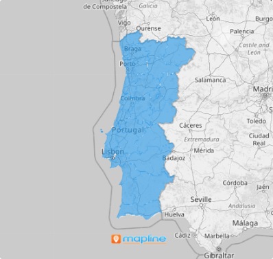
Creating a map of intermunicipal communities takes only a few seconds. Once generated, you can customize your maps even more for better visuals.
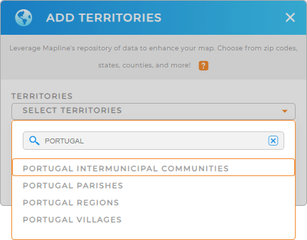
The first step is to access the ADD button on the left side of your map. Then, add a new territory from Mapline’s repository, type PORTUGAL into the search bar to trim down the selections, and select PORTUGAL INTERMUNICIPAL COMMUNITIES.
A map with attractive visuals invites more creative ideas that can contribute to drafting business plans. After choosing the right territory, we’ll go on to the second and last step.


Pro Tip: Mapline’s extensive repository of territory boundaries allows you to integrate regions from Portugal into your map, including Portugal regions, Portugal villages, Portugal parishes, and intermunicipal communities. Go ahead and explore these territories to expand your analysis and find the most effective approach for your business.
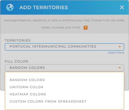
CHOOSE COMMUNITY COLORS
Step 2 is about transforming your map into a more powerful visualization tool through colors. Color-coding your territory map is a vibrant approach that allows you to effortlessly understand the narrative behind your data within defined boundaries.
To visualize the insights, select the best territory color styling that’s fitting to the type of analysis you’re doing. Lastly, click OK.
With your new map of Portugal Intermunicipal Communities, you can start to discover patterns and relationships that inform your strategic decisions.

GET NEW TERRITORY INSIGHTS
Leverage these advanced capabilities to enhance your analytics on your map:
- Optimize vehicle management with accurate forecasting
- Share datasets and visualizations in seconds
- Monitor your team performance 24/7


