RWANDA SECTORS
- Territory Guide
- RWANDA SECTORS
Ready to unlock the true power behind your numbers and turn insights into impact? Adding a map of Rwanda sectors to your analytics toolkit allows you to delve into the intricate stories woven through different perspectives. With this detailed territory map, identifying regional patterns and trends isn’t just easy—it’s transformative! Equip yourself to turn these insights into robust strategies for business growth and success.
It only takes a moment to integrate this territory into your map, setting the stage for powerful strategizing. Let’s get started and bring your map to life!
WHAT ARE RWANDA SECTORS?
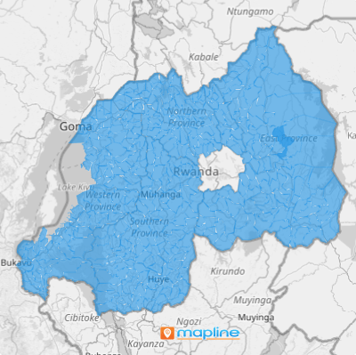
Positioned in the heart of Africa, Rwanda is famously known as the “land of a thousand hills” due to its breathtaking high altitude landscapes. This scenic country is meticulously organized into 416 sectors, each managed by a Sector Executive Committee dedicated to overseeing public service and safety.
For businesses in sectors like food production and distribution, incorporating these detailed boundaries into your data analysis can revolutionize how you engage with local markets. The granularity of Rwanda’s sectors enables a laser-focused examination of market dynamics, helping you pinpoint opportunities and tailor your strategies to meet precise local demands. Imagine the edge you’ll have when you can map out exactly where to boost your presence or optimize your distribution channels. Ready to turn these insights into actionable strategies? Let’s dive in and map out your success!
ADD RWANDA SECTORS
Get ready to accelerate your business growth when sector boundaries are added to your map! Once added, start creating sales territories, and monitor your business performance by individual sector.
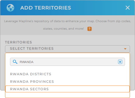
Click the ADD button on the left side of your map to add a new territory from Mapline’s repository. To make it simpler, type RWANDA in the search bar and select RWANDA SECTORS.
We’re almost done. We just need to complete one final step.


Pro Tip: Mapline’s extensive list of territory boundaries is available to unlock powerful new insights. Add precise regional boundaries to your map including Rwanda provinces, Rwanda districts, and Rwanda sectors for enhanced territory planning and management.
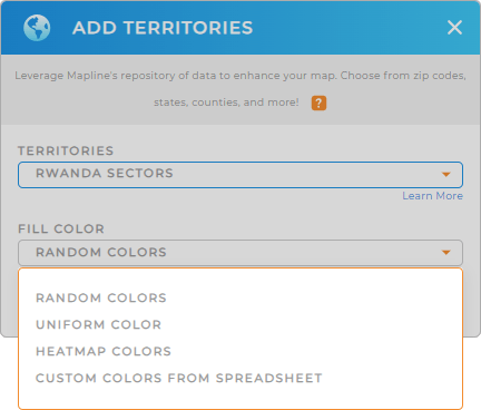
CHOOSE SECTOR COLORS
Color-coding your sector map based on data is an exceptional step to improve your decision-making as a business strategist. Colors are great visual representations of customer density, sales performance, or market penetration. How awesome is that?
Whether you want to apply heat maps or dynamic colors attached to your data, Mapline has got you covered with the best color styling !
When you’re done, click OK and that will wrap up adding Rwanda sectors to your map.

GET NEW TERRITORY INSIGHTS
Dive deep into your business performance and crack the code of market dynamics in every sector when you’re armed with these powerful capabilities:
- Set up a calendar as your command center for staying on top of events, deadlines, and appointments
- Eliminate the guesswork from optimized vehicle management to keep your fleet operating at peak performance
- Add a new report to track sales, monitor customer behavior, or uncover geographic trends easily


