SOUTH AFRICA WARDS
- Territory Guide
- SOUTH AFRICA WARDS
Add South Africa’s wards to your map and watch your analytics reach new heights! By visualizing these regions, you can tap into precise, location-specific insights that can transform your entire business operation. With a detailed view of each ward, you can see which areas are high-potential hotspots and which present challenges that need addressing. This empowers you to fine-tune your strategies, ensuring that your resources are allocated where they’ll have the most impact. Adjust your operations for maximum efficiency, streamline your efforts, and make data-driven decisions that drive success across all regions.
Supercharge your logistics strategy with actionable insights once you create a map of South Africa wards in just a few clicks!
WHAT ARE SOUTH AFRICA WARDS?
South Africa, located at the southernmost tip of the African continent, is divided into 4,392 wards, each with its own distinct characteristics and opportunities. By analyzing these unique boundaries, you unlock the potential to harness data-driven insights for strategic planning like never before.
A ward territory map gives you the edge in strategically allocating your sales force, allowing you to target areas with the highest potential for growth. Instead of a one-size-fits-all approach, you can tailor your efforts to the specific needs and opportunities of each ward. This level of granularity empowers you to maximize your impact, optimize resource allocation, and ultimately drive your business to new heights.
ADD SOUTH AFRICA WARDS
Make your South Africa wards map an integral tool to your analytics as you capture insights for targeted marketing. With a powerful map visual, imagine you can direct your marketing efforts and resources toward those that need a boost.
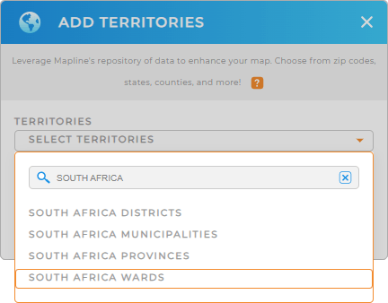
It’s so easy to achieve that! Just add a new territory from Mapline’s repository, type SOUTH AFRICA into the search bar, and select SOUTH AFRICA WARDS.
Now, the next step will leave you astounded.


Pro Tip: Mapline’s territory boundaries is a powerful asset to enhance your global logistics management. By adding boundaries like South Africa districts, South Africa provinces, South Africa municipalities, and wards, you can increase the efficiency of your logistics operations, route planning, and marketing strategies.
CHOOSE WARD COLORS
Imagine a color-coded map of South Africa wards based on sales performance. Colors are significant factors that help facilitate data-driven decisions by making insights more accessible. For instance, you can color-code the ward territories based on sales rep’s assignments, sales performance, number of visits, and more.
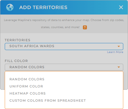
There are four color options to choose from. Choose the best color styles that fit your type of analysis.
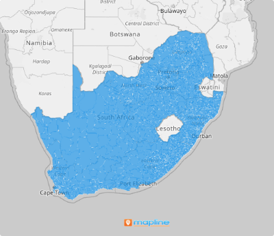
Click OK and we’re done! You’ve successfully created a map of South Africa wards in under a minute!

GET NEW TERRITORY INSIGHTS
Now, try adding these capabilities to your map of South Africa wards to achieve more precise insights for decision-making:
- Customize your pins to make your map more powerfully informative
- Combine multiple territories to find the best possible layout for your team
- Generate center points from your map pins to understand your market coverage


