SWAZILAND REGIONS
- Territory Guide
- SWAZILAND REGIONS
A map of Swaziland (Eswatini) regions is a valuable asset for businesses operating in this small but dynamic African nation. By visualizing regional boundaries, you can gain critical insights to optimize your strategies and achieve operational excellence. Mapline makes it easy to create and analyze your map for actionable results.
Add these region boundaries to your map now and get ready to gain the clarity to craft bold, precise strategies—empowering you to stay ahead of the curve and make confident, high-impact decisions every step of the way!
WHAT ARE SWAZILAND REGIONS?
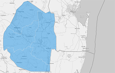
Swaziland, officially known as Eswatini, is divided into four administrative regions: Hhohho, Manzini, Lubombo, and Shiselweni. Each region is unique in its economic activity, cultural heritage, and geographical features. Mapping these regions helps businesses identify key markets, allocate resources efficiently, and streamline logistics across the country.
With this region territory map as your navigating compass to business success, you can reap ideas—fueling smart decision-making, precise planning, and powerful business execution. Imagine uncovering patterns that reveal regions rich in hotels, restaurants, and entertainment hotspots—prime areas for crafting laser-focused strategies that tap into vibrant local economies!
ADD SWAZILAND REGIONS
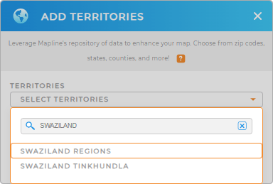
Get started by adding a new territory from Mapline’s repository. Search for “Swaziland” or “Eswatini” and select “Swaziland Regions.” Once added, your map will display the regional boundaries, ready for analysis.
This map provides the clarity you need to make data-driven decisions and maximize your impact in the region.


Pro Tip: Explore other administrative boundaries in Swaziland including Swaziland Tinkhundla by accessing Mapline’s worldwide repository of territory boundaries. Harness the power of multi-level mapping to reveal hidden opportunities, fine-tune your marketing strategies, and make smart, insight-driven decisions that elevate your entire operation.
CHOOSE REGION COLORS
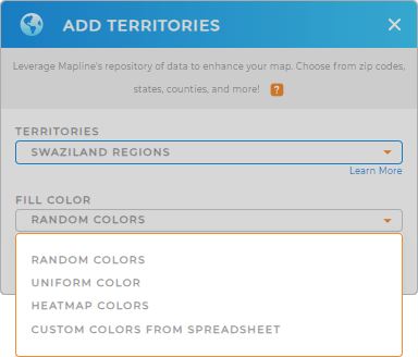
Bring your map to life by applying color styles. Whether you’re using static colors to highlight priority regions or dynamic colors for real-time data updates, your map will become a powerful tool for visualizing trends and opportunities.
A well-designed map enables you to act quickly and make smarter decisions.

GET NEW TERRITORY INSIGHTS
Mapline’s features give you the tools to transform your map into a strategic asset. Here’s what you can achieve with a Swaziland regions map:
- Create an instant map of job locations
- Document, verify, and track job completion in real-time
- Monitor and optimize jobs and instantly identify performance gaps


