SWEDEN MUNICIPALITIES
- Territory Guide
- SWEDEN MUNICIPALITIES
A map of Sweden municipalities is the right tool in your arsenal when it comes to making business decisions. For brands looking to stay ahead of the game, a map of Sweden’s municipalities is more than just a resource—it’s a superpower. Brands all over the world are using these maps to make informed decisions that keep them at the top of their game. If you’re serious about monitoring your business on a global scale, nothing beats having insights mapped out across municipality boundaries.
Follow these two simple steps to start your municipality-level analysis.
WHAT ARE SWEDEN MUNICIPALITIES?
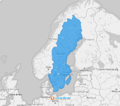
Taking a closer look at a Sweden municipality map is like zooming in on the fine details that make your business tick. With Sweden being one of Europe’s largest countries, spanning 290 municipalities, there’s a lot of ground to cover—literally.
By mapping out these municipalities, you’re not just looking at boundaries; you’re gaining a deeper understanding of how your business interacts with different regions. This insight allows you to fine-tune your product distribution strategy, ensuring that your offerings reach the right places at the right times. Whether you’re optimizing logistics or tailoring your services to meet local demands, this level of analysis gives you the power to make informed decisions that keep your business running smoothly and effectively across the vast landscape of Sweden.
ADD SWEDEN MUNICIPALITIES
Visualizing municipalities on a map lets you unlock deeper insights to optimize your supply chain, segment your customers, or plan for expansion. Be empowered to quickly capture insights and apply them immediately as you execute strategies for business growth!
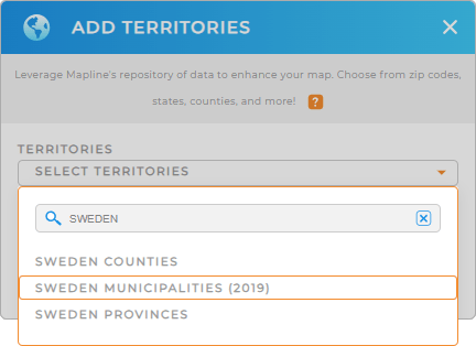
Simply add a new territory from Mapline’s repository, type SWEDEN into the search bar, and select SWEDEN MUNICIPALITIES.
See how easy Step 1 is? One last step and you can use your municipal territory map.


Pro Tip: Leverage Mapline’s extensive list of territory boundaries, including Sweden counties, Sweden municipalities, and Sweden provinces. The insights that you can get help significantly to make data-driven decisions to propel your business towards continuous growth and success.
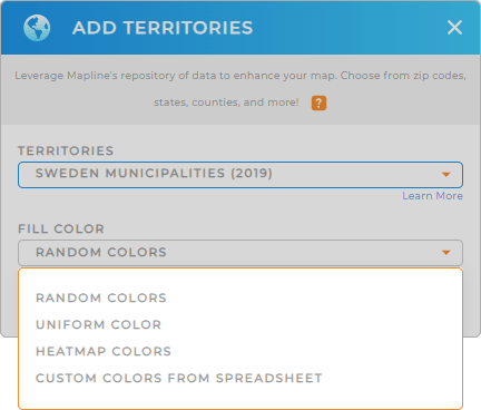
CHOOSE MUNICIPALITY COLORS
Adding colors to your territory map significantly trims your time spent in data analysis in half. By adding colors, your municipal territory map becomes a rich source of insights for important decision-making. Use static colors for visual clarity. Utilize dynamic colors to enhance your ability to interpret and analyze data.
Whatever color styles you choose, applying the right type of colors to your territories amplify your data and location understanding in a deeper level.
Finally, click OK. Now, get ready to analyze your data on a map of Sweden municipalities!

GET NEW TERRITORY INSIGHTS
Now that you’ve added Sweden municipalities to your map, try leveraging these powerful capabilities to wring out more insights:
- Group and sort data effortlessly by using category criteria
- Edit and style your routes for enhanced navigation
- Pinpoint your exact coordinates to save time, reduce mistakes, and make you more fficient


