TAIWAN PROVINCES
- Territory Guide
- TAIWAN PROVINCES
Do you want to supercharge your analytics? Well, start with a map of Taiwan provinces. With this map, you’ll see how it transforms your analysis, turning logistics and supply chains into a well-oiled machine. Picture this: pinpointing the perfect spots for your warehouses and distribution hubs, making your operations more efficient. It’s like having a secret weapon for uncovering new patterns and strategic moves in your business. Diving into those province boundaries will give you the edge to stay ahead.
Ready to take your strategy to incredible heights? Let’s start now!
WHAT ARE TAIWAN PROVINCES?
Taiwan, a unique country in Asia, is divided into two provinces and six special municipalities. The local government plays a crucial role in managing education, environmental protection, public safety, social services, transport, urban planning, and water management. Analyzing a province map can reveal new patterns and regional trends, providing valuable insights. By adding Taiwan’s provinces to your map, you unlock the full potential of your location data. It only takes a few seconds to transform how you understand and navigate these regions, empowering you to make more informed decisions.
Dive into the data, and see how mapping Taiwan can elevate your strategy.
ADD TAIWAN PROVINCES
A province map gives an in-depth provincial-level analysis that brings out insights you have never even imagined! Make your Taiwan province map work for you as you work on scenario planning such as identifying potential store locations or alternative routes.
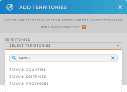
Significantly trim down your analysis as you add Taiwan provinces to your map by just adding a new territory from Mapline’s repository. Type TAIWAN into the search bar and then select TAIWAN PROVINCES.
See? You made it in just a few clicks!


Pro Tip: Create custom maps using Mapline’s Territory Repository including Taiwan counties, Taiwan districts, and Taiwan provinces. Territory maps provide a detailed visual representation for better strategic planning, resource allocation, and market penetration.
CHOOSE PROVINCE COLORS
Now, we’re almost done. The last step is to color-code your provincial map. Determining the appearance of your provinces on the map is crucial for extracting insights. Apply these insights as you create plans to enhance service delivery by addressing high-demand areas promptly.
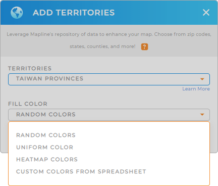
Choose the territory color styles to get insights from your analysis.
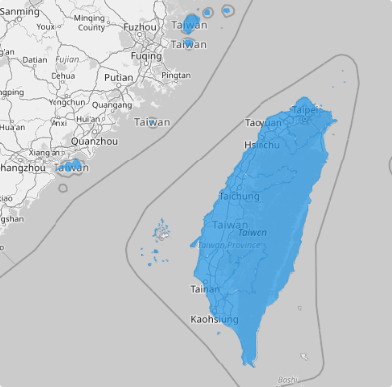
Click OK and you’re done. You made it! Your map of Taiwan provinces is ready to be analyzed.

GET NEW TERRITORY INSIGHTS
Boost your analytics and derive powerful insights for decision-making by incorporating the following advanced capabilities:
- Calculate anything about your data when you configure Mapline Data
- Customize charts to visualize key data and analyze results
- See all your customers in a glance when you create instant customer maps


