TRINIDAD AND TOBAGO MUNICIPALITIES AND REGIONS
- Territory Guide
- TRINIDAD AND TOBAGO MUNICIPALITIES AND REGIONS
A map of Trinidad and Tobago municipalities and regions is an indispensable tool for making smart business decisions. For brands aiming to stay ahead, this map is more than just a resource—it’s a game-changer! Companies around the globe are harnessing the power of these maps to make data-driven decisions that keep them on top. If you’re serious about managing your business on a global scale, nothing beats having a clear, detailed view of your business operations mapped across region and municipality boundaries. It’s the key to staying competitive and gaining a strategic edge.
Follow these two easy steps to add these regions to your map and start this granular level of analysis.
WHAT ARE TRINIDAD AND TOBAGO MUNICIPALITIES AND REGIONS?
Trinidad and Tobago, the Caribbean’s southernmost island nation, comprises the main islands of Trinidad and Tobago along with numerous smaller islets. Trinidad itself is divided into 14 distinct regions and municipalities—nine regions and five municipalities—each with a limited degree of autonomy. This structure provides a nuanced framework for governance and planning across the islands, supporting local needs while contributing to the nation’s vibrant cultural and economic landscape.
When you add these boundaries to your map, hidden patterns emerge, providing crucial factors for informed business planning. A map of Trinidad and Tobago’s regions and municipalities goes beyond basic navigation, revealing untapped business opportunities. By overlaying the boundaries of regions and municipalities, you get a powerful visualization tool that helps you identify key patterns, giving you the insight needed to determine where your startup stands between success and failure.
ADD MUNICIPALITIES AND REGIONS
Take a closer look at a Trinidad and Tobago municipality and region map. Zoom in on the fine details that make your business tick. It helps unlock insights that help optimize your supply chain, segment your customers, and guide your expansion. Be empowered to capture insights at a glance!
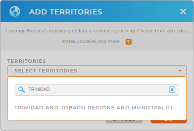
To do that, start by adding a new territory from Mapline’s repository, type TRINIDAD AND TOBAGO into the search bar, and select TRINIDAD AND TOBAGO MUNICIPALITIES AND REGIONS.
See how easy the first step is? Without further adieu, let’s embark on the last step.


Pro Tip: Leverage Mapline’s comprehensive list of territory boundaries, including Trinidad and Tobago municipalities and regions. Grasp countless insights to make data-driven decisions to help with your business’s continuous growth.
CHOOSE MUNICIPALITY AND REGION COLORS COLORS
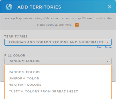
Now, color-code your territory map to cut your data analysis time in half, transforming it into a powerful resource for strategic decision-making. Static colors offer visual clarity, making it easier to spot trends, while dynamic colors boost your ability to interpret and analyze data in real time. This simple enhancement turns your municipal territory map into a rich, actionable tool for making informed decisions faster and more efficiently.
Choose your preferred color styles to amplify data patterns and trends, making complex information easier to interpret and driving more informed, impactful decisions.
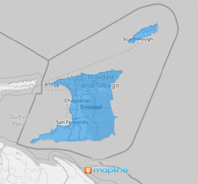
Once you click OK, you finalize the process of creating your map of Trinidad and Tobago municipalities and regions.

GET NEW TERRITORY INSIGHTS
Now, leverage these powerful capabilities to wring out the best insights from your data analysis:
- Sort data seamlessly by using category criteria
- Elevate your navigation experience by editing and styling your routes
- Harness the power of market demographics to generate sales forecasts to anticipate market trends


