U.K. COUNTRIES
- Territory Guide
- U.K. COUNTRIES
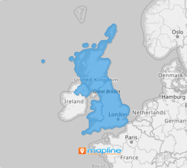
Turn complex information into a clear, actionable understanding by mapping the U.K. countries. A well-layered map does more than show boundaries; it reveals hidden patterns, regional vulnerabilities, and areas of concern that are otherwise easy to overlook. By overlaying national borders and key indicators, you gain a sharper view of where potential risks lie—whether you’re planning operations, allocating resources, or preparing for emergencies. This geographic clarity empowers faster, smarter responses when they matter most.
Navigate your business strategies through a map of the U.K. countries for regional accuracy, targeted engagement, and optimized operations. Break free from a one-size-fits-all approach, allowing them to unlock opportunities and maximize their growth potential in every corner of the U.K.
WHAT ARE U.K. COUNTRIES?
The United Kingdom (U.K.) is made up of four countries: England, Scotland, Wales, and Northern Ireland. Each of these countries has its own unique cultural, political, and economic characteristics, despite sharing the same central government. In addition to the four countries, there are distinct regional and local differences within each, which are often critical when tailoring business strategies.
With a map highlighting country boundaries, businesses can identify specific regions to target for local advertising campaigns, special promotions, or even product modifications. By pinpointing areas that align with their ideal customer segments, brands can increase conversion rates and improve engagement.
ADD U.K. COUNTRIES
Bring your strategies into sharp focus as you map U.K. countries! By visualizing boundaries and overlaying consumer behaviors, you gain a deeper understanding of where customer needs vary—and where new opportunities lie. Pinpoint areas with rising demand, track purchasing trends, and assess regional vulnerabilities that could impact inventory or footfall.
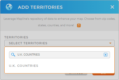
Turn complex information into clear, confident action—starting now! Start by adding a new territory from Mapline’s repository. In the searchbar, type U.K. COUNTRIES to click the right territory in no time.


Pro Tip: Step into a world of strategic possibilities with Mapline’s comprehensive collection of global boundaries. Start by diving into the U.K. boundaries, including the U.K. countries. Each layer provides unique insights, empowering you to fine-tune your approach and gain a competitive edge in any market.
CHOOSE COUNTRY COLORS
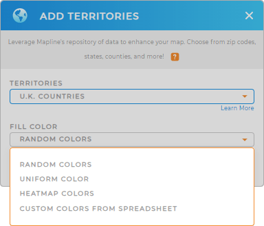
Explore detailed country-level insights with vivid territory colors—and let your map guide strategic growth with confidence. By color-coding your territories, you highlight patterns, uncover trends, and quickly spot areas of opportunity or concern. It’s a powerful way to focus on the regions that matter most, refine your strategy, and tell a clearer, more compelling story about performance and potential.
Mapline has the perfect color styles to make your insights pop and your projects shine. Choose the right type of colors that will adapt seamlessly to any analytical workflow.

GET NEW TERRITORY INSIGHTS
Unlock actionable insights with powerful capabilities. Dive deep into local trends, optimize strategies, and uncover hidden opportunities that drive smarter decisions and measurable growth.
- Automate demand forecasting to ensure that your fleet matches your delivery requirements perfectly
- Manage your calendar to keep your operations running at peak efficiency
- Automate your tasks, minimize manual effort, and ensure flawless operations when you apply button columns


