U.S. COMBINED CITY AND TOWN AREAS
- Territory Guide
- U.S. COMBINED CITY AND TOWN AREAS
Visualize your business operation on a map of U.S. Combined City and Town Areas to unlock powerful insights that make your business decisions faster, smarter, and more precise. By mapping out local factors within these boundaries, you can easily identify areas where your product is thriving and areas that may need more attention. This visual representation allows you to pinpoint market hotspots, tailor your marketing efforts, and optimize your distribution strategies, ensuring your business grows efficiently and effectively. With this level of detail, you can optimize operations, maximize growth, and minimize risks—all in just a fraction of the time it would normally take.
Ready to supercharge your business strategy? Start mapping your data at this level today and watch your decision-making process transform into a powerhouse of efficiency!
WHAT ARE COMBINED CITY AND TOWN AREAS?
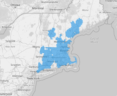
A map of the Combined New England City and Town Areas (NECTAs) provides a comprehensive view of their metropolitan and micropolitan statistical areas, as well as combined NECTAs and metropolitan NECTA divisions. Covering the six New England states—Connecticut, Maine, Massachusetts, New Hampshire, Rhode Island, and Vermont—this map details the components delineated by the United States Office of Management and Budget (OMB) using Census Bureau data and rigorous standards.
Transform this map into an analytic powerhouse to drive your business growth! By leveraging these detailed territory maps, successful brands unlock strategic insights for planning and expansion. Spot patterns, assess risks, and uncover hidden opportunities with ease. Whether you’re targeting specific regions or optimizing your market presence, this level of precision ensures you stay ahead of the competition.
ADD COMBINED CITY AND TOWN AREAS
Add these boundaries in seconds to make decisions based not on guesswork, but on a level of detail that reveals actionable insights. This process saves you time and resources, allowing you to focus on more strategic decisions.
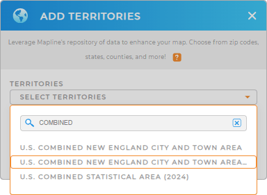
To quickly add a new territory from Mapline’s Repository, use the search bar to type in the keyword COMBINED. It will automatically show COMBINED NEW ENGLAND CITY AND TOWN AREAS. Click to add that to your map.


Pro Tip: Mapline’s global territory repository provides the most recent boundary for the U.S. Combined New England City and Town Areas. Leverage this territory to extract more valuable insights from your enhanced territory analysis.
CHOOSE CITY AND TOWN AREA COLORS
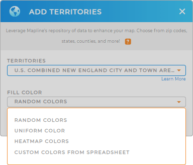
Ready to fuel unstoppable growth? Then, let’s add colors to your map and uncover the opportunities waiting for you! Color-code your territory to unlock the ability to quickly identify regional trends, make data-driven decisions, and optimize your strategies with precision.
Pick the color styles that suit your needs and turn your data into a dynamic, actionable asset!
Let’s wrap it up by clicking OK.

GET NEW TERRITORY INSIGHTS
Watch your business opportunities unfold as you apply these powerful capabilities to your analysis:
- Seamlessly transfer content between systems
- Level up your mapping game by generating center points
- Generate custom territories around your pins in just a few clicks


