U.S. ELECTRIC UTILITY SERVICE AREAS
- Territory Guide
- U.S. ELECTRIC UTILITY SERVICE AREAS
Unlock the power of a map of U.S. electric utility service areas to transform your business! Imagine crafting marketing campaigns that speak directly to the hyper-local market, refining your sales strategy, and optimizing delivery routes for unmatched efficiency! This territory is your gateway to gain deeper insights and adapt to each region’s unique rhythms—supercharging performance, outpacing competitors, and turning opportunities into success stories!
Ready to explore the possibilities? Let’s dive in and unleash the transformative power of detailed mapping, turning insights into impactful strategies that drive success!
WHAT ARE U.S. ELECTRIC UTILITY SERVICE AREAS?
The utilities sector comprises companies delivering essential services like electricity, natural gas, water, sewage, and more to both homes and businesses. These public utilities are often privately owned but operate under the oversight of public utility commissions, which typically regulate them at the state or regional level. This structure ensures reliable service while balancing public interest and business needs.
In business planning, mapping this detailed territory is a game-changer! It empowers you to make smart decisions. By diving into this level of analysis, you gain a detailed understanding of the market, enabling you to craft strategies that consistently hit the bullseye!
ADD U.S. ELECTRIC UTILITY SERVICE AREAS
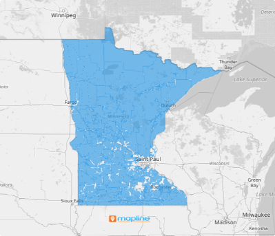
Watch your business soar to new heights as you add the electric utility service areas to start analyzing your data. Dive into the details, understand the area dynamics, and craft targeted plans that resonate with each utility service area.
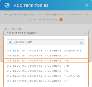
To do that, you need to add a new territory from Mapline’s repository. To cut the time searching, use the search bar to type the keyword ELECTRIC, and choose U.S. ELECTRIC UTILITY SERVICE AREAS. Then choose your preferred state.


Pro Tip: Discover the freshest U.S. electric utility service area boundaries, right at your fingertips, with Mapline’s Repository! Sourced directly from the U.S. Census Bureau, these boundaries cover key states including California, Kentucky, Maine, Minnesota, Mississippi, North Carolina, South Carolina, and Ohio. Simply select the latest year from the drop-down menu to be equipped with the most up-to-date boundary data available.
CHOOSE ELECTRIC UTILITY SERVICE AREA COLORS
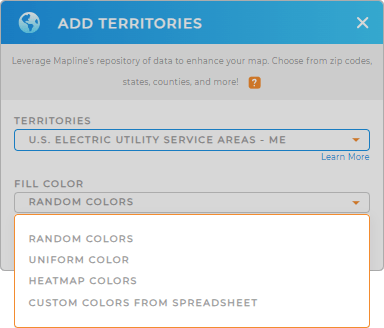
Now, we’re in the final touch. Choose the perfect fill color for your territory and bring geographic trends to life, helping you spot key factors affecting city residents. By visualizing these insights, you can make meaningful connections and align your city initiatives with the real, pressing needs of the population.
Apply the best territory color styles transform your map into a powerful, intuitive decision-making tool! Lastly, click OK. Now, make your map work for you!

GET NEW TERRITORY INSIGHTS
Leverage these powerful capabilities to enhance your analysis on a map of U.S. Electric Utility Service Areas:
- Supercharge your brand with game-changing workflows that revolutionize the way you do business
- Keep your business thriving with smart sales routes in seconds
- Set up a calendar that automatically updates as your information changes


