U.S. METROPOLITAN DIVISIONS
- Territory Guide
- U.S. METROPOLITAN DIVISIONS
Using a map of the U.S. Metropolitan Divisions puts your brand at street level—where decisions feel personal, results are measurable, and strategy meets reality. Whether you’re moving products, opening stores, or analyzing trends, this boundary system lets you act locally without losing sight of the bigger picture. Unlock the power of visualization and turn complex details into crystal-clear insights. With this dynamic territory map, you’ll uncover hidden patterns, sharpen your focus, and spot opportunities at the district level like never before.
Supercharge your brand presence and watch your strategy come alive—one metro division at a time. Start mapping your success today!
WHAT ARE U.S. METROPOLITAN DIVISIONS?
U.S. Metropolitan Divisions are subregions within larger Metropolitan Statistical Areas (MSAs) that have a population of 2.5 million or more. They are defined by the U.S. Office of Management and Budget (OMB) and represent economically and socially distinct areas within large metro regions. Essentially, they break down huge urban centers (like New York City or Los Angeles) into smaller, more manageable zones that still reflect real-world commuting, economic, and social patterns.
Metropolitan Divisions offer a finer level of detail than whole metro areas. For instance, your sales team can make a more granular market understanding. They may discover that different consumer behaviors between New York–Jersey City–White Plains and Nassau County–Suffolk County. By mapping the U.S. Metropolitan Divisions, you can tailor your strategies to localized preferences or demographics.
ADD METROPOLITAN DIVISIONS
Bring your strategies to life with a U.S. Metropolitan Divisions map! A map of the U.S. Metropolitan Divisions helps brands see clearly, act locally, and scale strategically. It transforms massive urban markets into actionable territories—perfect for building a brand that resonates with real people, in real places.
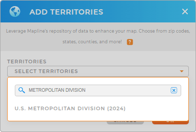
Achieve that by adding a new territory from Mapline’s repository. Type METROPOLITAN in the search bar to easily add U.S. METROPOLITAN DIVISIONS to your map.


Pro Tip: Mapline’s global territory repository is a powerful hub for special territories such as the U.S. Metropolitan Divisions that can be quickly added to your map. Mapping these territories can help you unlock localized insight that sharpens your strategy, boosts performance, and maximizes operational impact—where it matters most.
CHOOSE DIVISION COLORS
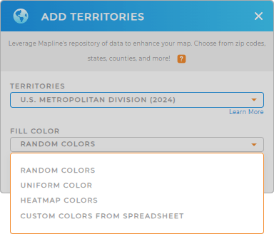
Empower strategic decisions with a map that does more than show locations—it reveals performance. With smart territory color styles, you can instantly spot high-growth zones, monitor trends, and align regional strategies with company goals—all in one view.
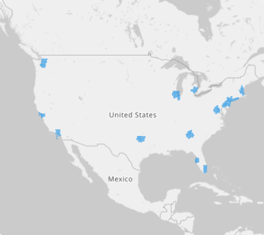
After picking the right type of colors that match your analytics, click OK to start exploring your map of U.S. Metropolitan Divisions.

GET NEW TERRITORY INSIGHTS
Apply these advanced capabilities to uncover deeper, more powerful insights that drive smarter decisions:
- Adjust the color or thickness of your route lines on your maps for enhanced visibility
- Add center of minimum distance to pinpoint travel challenges
- Predict market trends and gain the clarity to effectively allocate resources


