VANUATU PROVINCES
- Territory Guide
- VANUATU PROVINCES
Adding Vanuatu provinces to your map is more than just plotting points—it’s about uncovering opportunities you never knew existed. With provincial boundaries in place, you’ll unlock game-changing insights that elevate your business from good to extraordinary! Gain a crystal-clear view of your market landscape and make decisions with superhero-like precision.
Ready to power up your territory analysis? Don’t wait—add these boundaries now and step into greatness today!
WHAT ARE VANUATU PROVINCES?
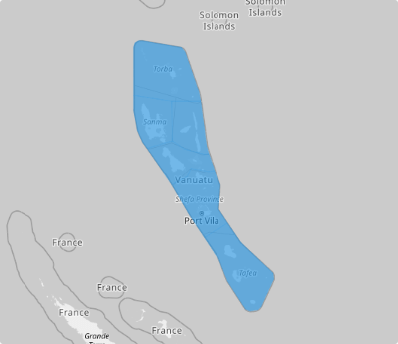
Vanuatu, a tropical paradise in Melanesia, graces the azure waters of the South Pacific Ocean. Since 1994, this enchanting island nation has been organized into six provinces, each offering its own unique blend of culture, history, and natural beauty. These provinces form the foundation of Vanuatu’s local governance, connecting its communities across the archipelago.
Add a map of Vanuatu provinces to your analytical toolkit now! It’s like having a clear roadmap to smarter decisions and streamlined strategies. In short, it’s an essential step to making your work simpler and your results stronger!
ADD VANUATU PROVINCES
Plotting provincial boundaries on your map isn’t just a smart move—it’s a game-changer! These boundaries give you the power to quickly uncover insights about location, target markets, foot traffic, and existing customers.
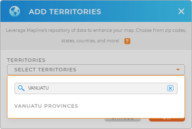
Unlock the full potential of your map as you add a new territory from Mapline’s repository. In the search bar, type VANUATU to quickly click to add VANUATU PROVINCES.
Now, you’re one step away from getting the most out of your province map.


Pro Tip: Mapline’s repository of territory boundaries makes it effortless to add Vanuatu’s provinces to your map. With these precise boundaries, you’ll be empowered to dive deep into hyper-focused insights, running detailed analytics that sharpen your strategies and drive smarter decisions.
CHOOSE PROVINCE COLORS
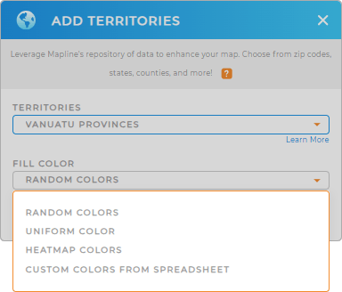
Looking for even more actionable insights? It’s time to add some color to those provinces! Colors aren’t just for aesthetics—they’re the secret weapon that transforms your map into a powerful decision-making tool. With a color-coded map, trends and business variables leap off the screen, making it easier than ever to spot opportunities and challenges.
In minutes—or even seconds—you’ll uncover key insights that drive smarter, faster decisions. Bring your map to life as you apply the best color styles and take your analysis to the next level!

GET NEW TERRITORY INSIGHTS
Elevate your strategies and navigate your business landscape with these powerful capabilities in your analytics:
- Optimize delivery routes to enhance customer satisfaction across all provinces
- Uncover patterns that reveal valuable insights into future demands specific to each province
- Create interactive dashboards to monitor market penetration by province in real time


