ZIMBABWE PROVINCES
- Territory Guide
- ZIMBABWE PROVINCES
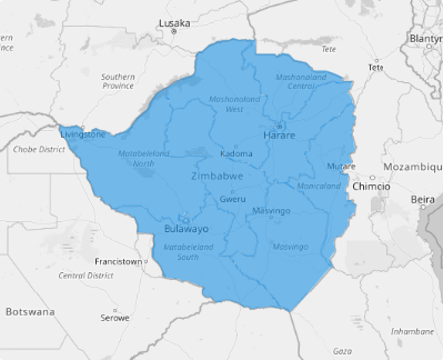
Take your data analysis to the next level by visualizing it on a map of Zimbabwe provinces. With clearly defined provincial boundaries, you can uncover patterns and trends that might otherwise go unnoticed, gaining a comprehensive view of how your data behaves across the country. By visualizing these boundaries, you can dive deep into regional demographics, market trends, and consumer behavior. A province map is more than just a tool—it’s your competitive advantage!
Adding provincial boundaries to your map takes just seconds, but the impact is lasting. Whether you’re optimizing operations, identifying growth opportunities, or fine-tuning your market approach, a Zimbabwe province map is your key to staying ahead in a dynamic landscape.
WHAT ARE ZIMBABWE PROVINCES?
Nestled between the Zambezi and Limpopo Rivers in Southeast Africa, Zimbabwe is a landlocked nation rich in culture and opportunity. The country is divided into ten administrative provinces, two of which—Harare and Bulawayo—hold the unique status of cities with provincial authority. As a unitary state, the provinces operate under powers delegated by the central government.
Understanding the dynamics of these provinces is your gateway to building a winning strategy. By delving into the distinct characteristics of each province, you can Identify opportunities and challenges unique to each province, align your approach with local market dynamics for maximum impact, and make data-driven decisions that resonate with specific provincial needs.
ADD ZIMBABWE PROVINCES
By mastering Zimbabwe’s provincial landscape, you’re not just navigating the market—you’re elevating your strategy, and creating a roadmap for sustainable growth and success.
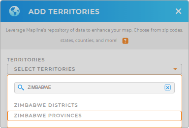
Let’s navigate your success through provincial insights. Start by adding a new territory from Mapline’s repository. Type ZIMBABWE in the search bar and choose ZIMBABWE PROVINCES.


Pro Tip: Access Mapline’s global territory repository to add international boundaries to your map including Zimbabwe districts and provinces. Analyze key metrics in minutes and gain new ideas to chart successful territory plans.
CHOOSE PROVINCE COLORS
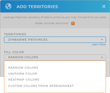
Now let’s add fill colors for your territory. This vibrant approach not only simplifies your process but empowers you to identify opportunities with confidence and precision! With color-coded maps, you can make strategic decisions backed by data, all while staying ahead of the competition.
Pick out the best color styling option to quickly identify trends and opportunities.

GET NEW TERRITORY INSIGHTS
Course through your strategies as you incorporate these powerful capabilities into your analytics:
- Track customer data all in one place
- Craft location-based marketing strategies with style
- Turn your data into visual insights


