Quick Reference Guide
Maps: Settings
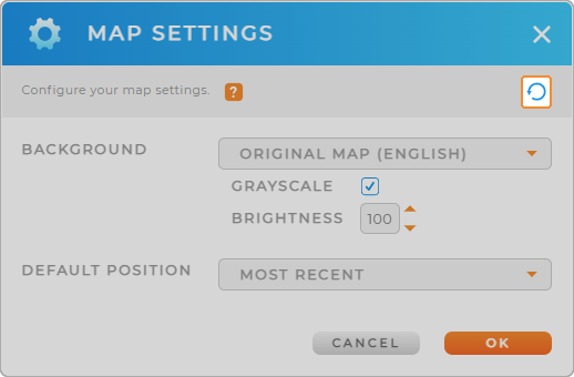
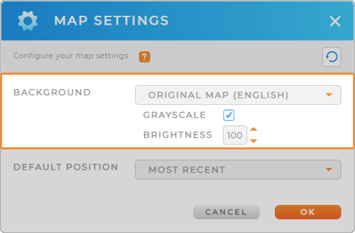
BACKGROUND
Original Map (English/ Multilingual): This is your standard 2-D map, shaded to reflect the roads and landscape. Select ‘Multilingual’ if you want to see location names displayed in their original language.
Bright Map: This is a brighter, less-detailed version of the original map. If the original map is too cluttered for you, this is a great option!
Solid Color: Set a solid background color to eliminate the map terrain and only display territories and pins.
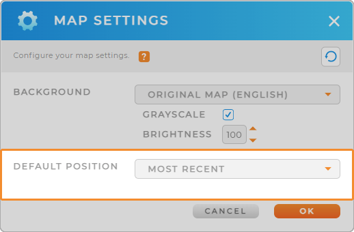
DEFAULT POSITION
Tired of zooming and panning around every time your map reloads?
Use your current position or a custom position on the map as your default. This way, every time you access your map, it will already be focused on the area you want to see.
It even gets as specific as setting an exact latitude and longitude as your default position. Adjust the zoom level you need (the higher the number, the more zoomed in you’ll be), and you’re all set!
RESET SETTINGS