MAPLINE
February 2022
UPDATES
MAPLINE
February 2022
UPDATES
As time goes on, we find more and more that our best features come from user feedback. So, keep the suggestions coming! We’ll keep churning out incredible updates that help you make the most of your data.
Curbside Routing is Here!
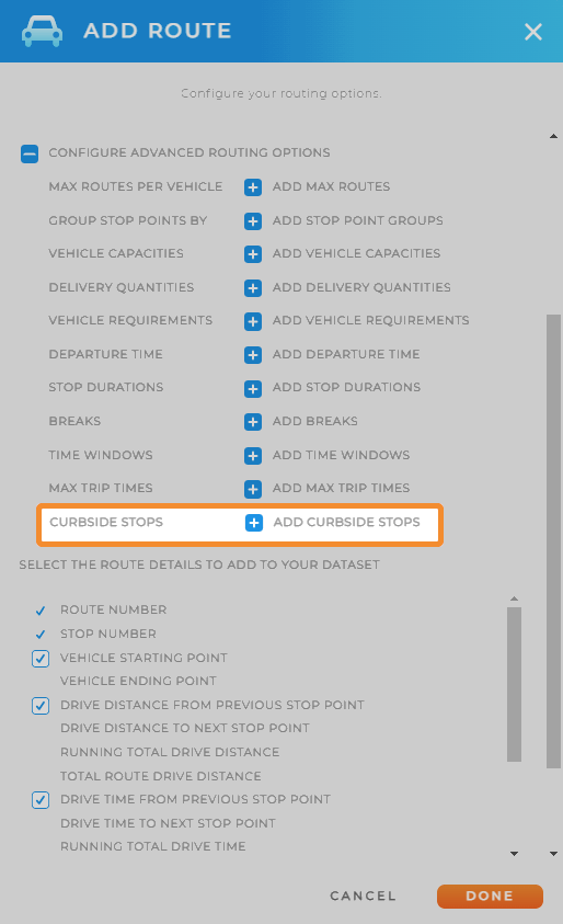
Curbside routing is available in Mapline! We couldn’t hide our excitement about this update if we wanted to.
No more headaches or hours spent re-routing and figuring out where your vehicles can turn around.
Instead, use our advanced system and automatically generate itineraries that are configured for curbside pick-up and drop-off.
Dance break, anyone?

Better Insights with Chart Sorting
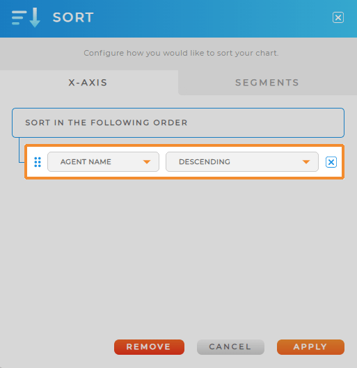
Now, there are many different ways to sort data in charts. You can reorder data on both the X and Y axis, or sort by segment.
Your dashboards will be even more useful with this new feature. For example, you can see which sales rep has the most open opportunities, and segment the chart by sales stage.
There are so many different ways you can leverage chart sorting to improve your data insights. Click here to try it out for yourself. >>

Remove Territory Holes with a Single Click
Sometimes, you build your own territories by combining county and zip code boundaries. This can create ‘holes’ in your territories due to government-defined boundaries.
But sometimes it’s nice to simplify the look and feel of your map. Now, with a single click, you can remove holes and create a more uniform, whole appearance for your territories.
Not only does this create better aesthetics, but your maps will be easier to read with more consistent colors and styling.
Set Map Zoom Level with URL Variables
Do you want a map to load zoomed in on a particular area every single time?
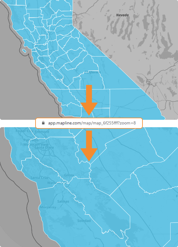
Pre-set your maps to load at certain zoom levels using URL variables.
When you add the variable, ‘?zoom=#’ to the end of your URL, your map will automatically zoom in to the level you choose.
This makes it easy to go straight to the area you need on your map, without having to adjust it manually every time.
As a reminder, you can also use URL variables to search on your map, or to create coverage circles. Here is a list the URL variables currently available in Mapline:
- ?zoom=#
- ?search=address
- ?search=city,state
- ?coveragecircle=# mi/ km
These variables can be especially helpful if you want to see data in a particular zip code, or if you want to display a circle around a particular area.
For more information about using URL variables, check out our help article.

Field Validation in Forms
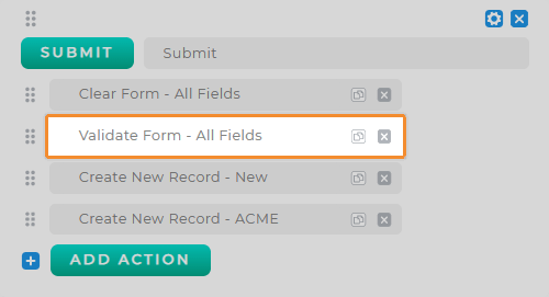
Add a step to your forms to verify that phone numbers and email addresses are completely filled out. This way, you can be sure you’re collecting the most accurate and complete information possible.
New to forms? Well brace yourself, because now you can collect data on the road and get the most up-to-date insights right in Mapline.
Talk to your Account Executive about Forms today. This feature will rock your world!


