- Blog
- Geo Mapping OR RIGHT PRODUCT
- Why Every Growth-Focused Business Needs Location Intelligence Software
In today’s hypercompetitive markets, growth isn’t just about working harder—it’s about working smarter. Businesses that scale effectively know how to identify hidden patterns, anticipate market trends, and act quickly when new opportunities arise. That’s where location intelligence software comes in.
By combining spatial data analysis with real-time business data, location intelligence gives companies a visual way to understand what’s happening, where and why it matters. It goes far beyond pin drops on a map. With the right tools, your team can track performance across locations, optimize distribution, plan new store rollouts, and uncover untapped customer segments with precision.
Let’s explore why location intelligence is becoming a core pillar for modern business strategy, and how leading companies are already using it to transform their growth trajectories.
The Competitive Edge of Location Intelligence
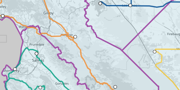
Location intelligence software turns raw data into business clarity. By plotting data points on a map, like customer locations, delivery routes, or sales territories, you instantly unlock a new dimension of insight. These visuals make it easier to ask the right questions and make fast, confident decisions backed by data.
For example, instead of guessing which territories are underperforming, you can visually identify coverage gaps. Rather than debating the best site for your next store, you can layer in demographics, traffic patterns, and competitor proximity to determine the ideal location. From store location planning to real-time location tracking, the applications are vast—and the returns, measurable.


Pro Tip: Want to see location intelligence in action? Try Mapline’s Location Intelligence platform to create layered maps, track activity in real time, and build smarter business strategies with spatial data.
Real Business Use Cases
Businesses across industries are leveraging location intelligence tools to improve efficiency, cut costs, and scale faster. From logistics to retail to field service management, real-world applications of these tools are transforming operations and driving smarter decisions. By layering spatial data with business insights, companies can quickly identify gaps, opportunities, and performance trends. This enables them to take action faster, with better visibility and confidence. Whether it’s optimizing routes, evaluating store placement, or tracking asset movement, location intelligence plays a critical role in competitive growth. Here are two standout examples:
Scooter’s Coffee: Cutting Travel Expenses by 47%
Scooter’s Coffee used Mapline’s capabilities to build optimized delivery routes across multiple franchise locations. By using real time location data to plan smarter routes, they eliminated unnecessary mileage and reduced travel expenses by nearly half. That’s not just a cost savings; it’s time and fuel redirected into growth.

Quality Enclosures: Reducing Delivery Costs by 30%
With Mapline software, Quality Enclosures was able to visualize customer locations and streamline delivery planning. The result? A 30% reduction in delivery costs and a more scalable model for expansion. Visualizing spatial relationships helped the team make smarter resource decisions and serve their customers faster.

Key Capabilities to Look For in Location Intelligence Software
When evaluating GIS for business or geospatial business intelligence platforms, make sure the software includes the following core features. The right tool should do more than just plot points on a map; it should empower your team to make informed, data-driven decisions. Look for platforms that integrate seamlessly with your existing systems and allow you to analyze, visualize, and act on location-based trends. Real-time insights, customization options, and scalable reporting are key to supporting operational agility. Whether you’re managing a nationwide fleet or a growing network of retail stores, the best platforms will flex to fit your unique needs. Here are the most essential capabilities to prioritize:
Spatial Data Layering
Overlay customer data with sales performance, demographic info, or competitor locations to reveal patterns you wouldn’t catch in a spreadsheet. This multilayer approach allows you to see relationships between datasets that may otherwise go unnoticed. For example, layering income demographics over store performance can highlight underserved high-potential areas. You can also identify regions where your marketing isn’t aligned with market demand. The more contextual data you apply, the more accurate your business insights become.
Real-Time Location Tracking
Monitor delivery teams, mobile assets, or field reps with live updates that support fast decisions and service accountability. Real-time tracking helps leaders respond immediately to delays, route deviations, or missed appointments. It also builds customer trust by enabling accurate ETAs and real-time notifications. In industries like logistics or field service, this level of visibility can drastically reduce service failures and downtime. Ultimately, it ensures your team is always operating at peak efficiency.
Route Optimization & Territory Management
Balance workloads, reduce travel time, and plan strategic coverage areas with mapping tools that adapt to your business model. Intelligent route optimization eliminates guesswork and ensures that each team member is assigned the most efficient path. Likewise, territory management tools help you align sales coverage with market potential, not just zip codes. This results in more balanced pipelines, happier reps, and improved customer service. A flexible system lets you adjust territories on the fly as demand shifts.
Custom Reporting and Visualization
Share interactive dashboards with executives, team leads, or franchise owners—turning location data into clear, actionable insights. Custom reporting tools allow you to segment metrics by region, rep, or customer tier, making it easier to spot performance gaps. Visualizations like heat maps, charts, and trend lines remove ambiguity from your data and help stakeholders make decisions faster. When paired with live data inputs, reports can automatically update to reflect new insights in real time. This keeps your entire organization aligned on what’s happening and where.
Start Scaling With Spatial Data
Growth-focused companies don’t just collect data, they use it to their advantage. Location intelligence software bridges the gap between raw numbers and strategic decisions, giving your team the power to act quickly and with confidence. Whether you’re optimizing routes, expanding to new territories, or uncovering market trends, location analytics give you the edge you need to lead.
Location intelligence software helps businesses visualize, analyze, and act on spatial data. It combines geographic information with operational data to reveal insights about customer distribution, sales trends, logistics efficiency, and market opportunities. By connecting the “where” to the “what,” it enables smarter, faster decisions. Companies use it to drive everything from territory planning to site selection.
It allows leaders to identify high-potential markets, uncover inefficiencies, and optimize resource allocation based on real-world geography. Growth-focused businesses use location intelligence to improve customer targeting, reduce overhead, and scale strategically. When your decisions are guided by spatial data, you can enter new regions more confidently and serve existing ones more effectively.
While any business can use location intelligence, it’s especially impactful for those with distributed teams, physical locations, or logistics operations. Field service companies, franchise networks, retail chains, and logistics providers often see the greatest ROI. That said, even digital-first brands can use location data to refine advertising, understand regional trends, and manage customer engagement.
Traditional BI tools focus on charts and graphs, but location intelligence layers your data onto interactive maps—adding spatial context. This helps you spot geographic patterns and outliers you might miss otherwise. It’s the difference between knowing your sales are down and knowing exactly where and why they’re down.
Yes. Most location intelligence platforms support integrations with CRMs, spreadsheets, ERPs, and third-party databases. This means your team can pull in customer data, transaction histories, or performance metrics and visualize them geographically without switching systems. The result is a seamless, insight-rich experience.
A coffee chain might use location intelligence to plan store expansion by analyzing foot traffic, competitor presence, and customer density. A field service company might optimize technician routes and balance territories to reduce fuel costs and boost service quality. The use cases are nearly endless—what they have in common is turning location data into action.