QATAR MUNICIPALITIES
- Territory Guide
- QATAR MUNICIPALITIES
A map of Qatar municipalities is a go-to tool for many successful brands operating in the Middle East to capture timely business insights. Brands leverage this map for competitor analysis, visualizing where competitors are concentrated to uncover underserved areas with growth potential. It’s also invaluable for optimizing logistics and distribution, helping businesses plan efficient delivery routes that reduce travel time and costs.
With such strategic insights, you can streamline operations, enhance your market positioning, and drive profitability in a competitive landscape. Let’s check it out together.
WHAT ARE QATAR MUNICIPALITIES?
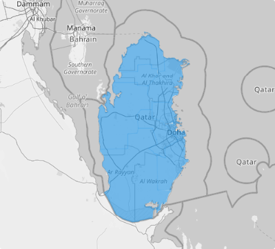
Qatar, a dynamic nation in West Asia, is organized into eight municipalities. For detailed statistical and administrative purposes, these municipalities are further divided into 98 zones, reflecting the country’s commitment to efficient governance and planning.
Mapping these administrative boundaries unlocks a deeper understanding of local dynamics, making it an indispensable tool for strategic decision-making across retail, logistics, and more. Whether you’re analyzing consumer behavior, streamlining distribution networks, or crafting targeted regional marketing campaigns, integrating municipal boundaries into your maps delivers the clarity and actionable insights you need to drive success.
ADD QATAR MUNICIPALITIES
Add municipality boundaries to your map effortlessly to harness the power of geographic data, empowering you to work smarter and faster. Elevate your operational efficiency and sharpen your strategic planning with your Qatar municipalities map today!
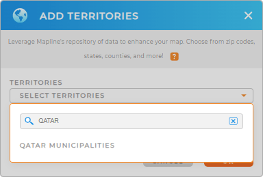
Just add a new territory from Mapline’s repository. Using the search bar, type QATAR to quickly add QATAR MUNICIPALITIES to your map.
How fast can that be?


Pro Tip: Mapline’s worldwide territory repository provides different territory boundaries including Qatar municipalities. Explore this territory and gain invaluable insights into your business performances in competitive landscapes.
CHOOSE MUNICIPALITY COLORS
Now that you have the right territory, let’s give your map the visual boost it deserves to bring hidden insights to life. It’s time to add colors! Coloring your map does more than just distinguish regions—it transforms your analysis into a dynamic, visual story that’s easy to interpret and packed with actionable insights.
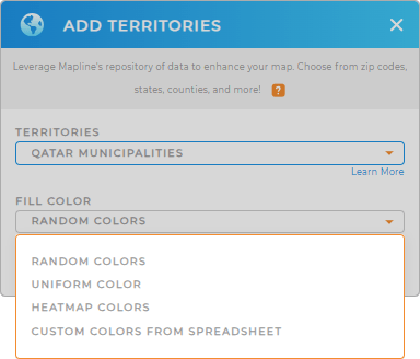
Mapline provides outstanding color styles to choose from. Carefully select the one that allows you to glean more valuable insights. Once you’ve made your decision, click OK.

GET NEW TERRITORY INSIGHTS
Level up your analytics by leveraging these Mapline’s advanced capabilities:
- Create a powerful system that analyzes market dynamics on demand
- Understand market overlap in seconds
- Segment charts to spot factors impacting sales


