East Timor Municipalities
- Territory Guide
- East Timor Municipalities
Elevate your business planning by mapping the municipalities of East Timor. By visualizing these municipal boundaries, you gain essential insights into local geographic patterns, market trends, and regional dynamics that directly influence your business operations and strategic decisions. Mapline’s powerful visualization tools enable you to create and manage highly effective, location-specific sales territories.
Mapping East Timor’s municipalities provides a clearer understanding of local market conditions, helping you identify new opportunities, optimize resources, and enhance your market strategies. Utilize these insights to stay ahead in a competitive landscape.
WHAT ARE EAST TIMOR MUNICIPALITIES?
East Timor, officially known as Timor-Leste, is divided into several municipalities, each with unique economic and demographic profiles. Understanding these municipal boundaries is crucial for effective market analysis, resource allocation, and targeted marketing efforts.
Businesses can use municipal-level data to refine strategies, improve operations, and better engage with local customers. Mapping these municipalities offers valuable insights into regional strengths and opportunities, facilitating more informed decision-making.
ADD MUNICIPALITIES
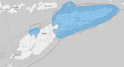
Incorporating East Timor’s municipal boundaries into your map enhances your ability to analyze and strategize effectively. This detailed visualization supports informed decision-making and operational efficiency.
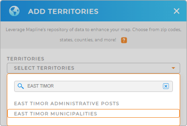
To add these areas to your map, add a new territory from Mapline’s repository and type EAST into the searchbar. Select EAST TIMOR MUNICIPALITIES, and you’re all set!
You’re halfway there to gaining new understanding regional dynamics and areas with high potential for growth.


Pro Tip: Utilize Mapline’s extensive territory repository to explore other regions including East Timor administrative posts and municipalities, and uncover deeper insights for strategic planning. Tap into other worldwide regions to enhance your analytics and strategic decision-making.
CHOOSE MUNICIPALITY COLORS
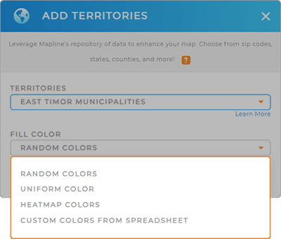
Applying colors to East Timor’s municipalities improves your data visualization by making trends, performance metrics, and critical areas more apparent.
Simply select your preferred color styling option, then click OK.
Woah! You just tailored your map to empower your analytics and support effective business strategies. That’s amazing!

GET NEW TERRITORY INSIGHTS
Leverage Mapline’s advanced features to uncover deeper insights:
- Create a seamless link between your visualizations and insights to help you make smart decisions
- Embed interactive maps on your website to empower your customer to find what they need
- Learn how far customers are willing to travel to your stores by analyzing the distance between your audience and locations


