CROATIA COUNTIES
- Territory Guide
- CROATIA COUNTIES
Leverage a map of Croatia counties in your analysis! Small boundaries like counties are a perfect fit for a more granular analysis, providing local insights that help in creating highly-targeted strategies at a local level.
Gain insight into regional performance, sales territory optimization, or cutting back expenses. This type of mapping helps identify high-potential areas, allocate resources efficiently, and improve overall business operations. Let’s dive in and learn how to add Croatia counties to your maps in seconds!
WHAT ARE CROATIA COUNTIES?
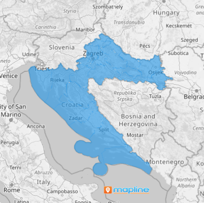
Croatia is divided into 21 counties, each serving as an administrative region. These counties play a crucial role in regional governance and planning.
Leverage county-level maps to analyze market penetration, manage distribution channels, or tailor marketing strategies to specific regions. Mapping counties provides a comprehensive view of regional dynamics, enabling more informed business decisions.
ADD CROATIA COUNTIES
In business, location is key. When you can see everything about the landscape of each county, you gain a competitive edge in the market.
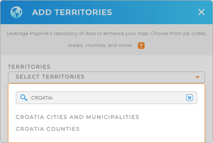
First, add a new territory from Mapline’s repository. Type CROATIA into the searchbar and select CROATIA COUNTIES.
Adding this territory allows you to start your county-level analysis and visualizations, enhancing your strategic planning.


Pro Tip: Mapline’s worldwide territory repository offers an extensive list of territory boundaries, including Croatia municipalities and cities. Gain deeper insights into your data and uncover new opportunities by comparing and contrasting different types of administrative boundaries against your data.
CHOOSE COUNTY COLORS
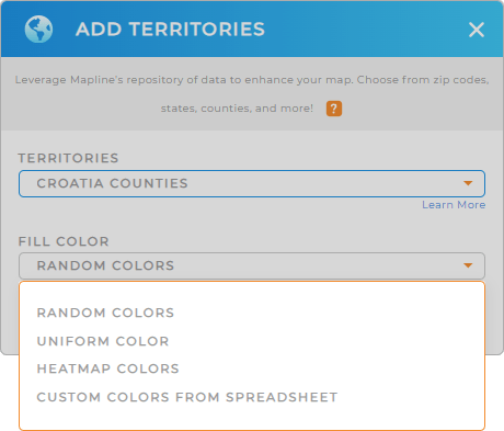
Assigning colors to Croatia Counties enhances visualization and aids in business analytics. Color-coded counties help you quickly identify performance metrics, demographic trends, and regional patterns at a glance, optimizing your decision-making process.
Just select your preferred color styling, then click OK.
What a powerful way to highlight critical points that help you distinguish between high and low-performing regions, or other KPIs impacting your bottom line.

GET NEW TERRITORY INSIGHTS
Unlock a wealth of insights with Mapline’s powerful capabilities tailored for county maps:
- Visualize data density across Croatia’s counties to identify hot spots and areas requiring attention
- Spot patterns effortlessly —no more tedious manual entry, missed trends, or time-consuming reports slowing you down
- Adjust territory styles based on performance metrics or other key indicators to easily identify areas of interest


