ZAMBIA DISTRICTS
- Territory Guide
- ZAMBIA DISTRICTS
Dive into Zambia districts to uncover new opportunities, make informed decisions, fine-tune your strategies, and fuel significant business growth. This isn’t just a tool—it’s your gateway to smarter decisions and unstoppable success. A district-by-district map is your guide to identifying local demographic trends and market dynamics, giving you the precision to craft winning sales strategies. Imagine having the power to tailor your approach to each unique market, meeting the needs of your customers with pinpoint accuracy!
Armed with these valuable insights, seize opportunities, refine your operations, and set your business on a path to sustainable growth.
WHAT ARE ZAMBIA DISTRICTS?
Once known as Northern Rhodesia, the Republic of Zambia is a vibrant country in Southern Africa, now divided into 103 districts. These districts are structured to support initiatives like poverty reduction, efficient resource utilization, and population risk management.
By mapping Zambia’s districts, you gain a powerful tool to analyze demographics, population trends, and sales and marketing opportunities. This insight enables you to design strategic programs tailored to the unique dynamics of each district, driving impactful outcomes and sustainable growth.
ADD ZAMBIA DISTRICTS
Ready to elevate your operations and plan for long-term success? Discover how district-level mapping can unlock new opportunities and transform the way you approach business strategy in Zambia.
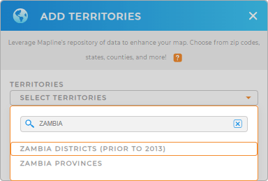
In just a few seconds, you can add a new territory from Mapline’s repository. Use the search bar to type ZAMBIA and select ZAMBIA DISTRICTS.
One more step to go and you can start exploring your district map.


Pro Tip: Explore Mapline’s repository and discover fresh insights as you add territories to your map including Zambia provinces and districts.
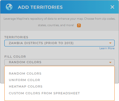
CHOOSE DISTRICT COLORS
With a color-coded municipality map, you’ll navigate Albania’s market complexities with confidence, clarity, and precision. It’s not just about seeing the data—it’s about using it to uncover new paths to growth and success.
Let your map become the guiding force for your next breakthrough as you select the perfect color styles for your analysis.
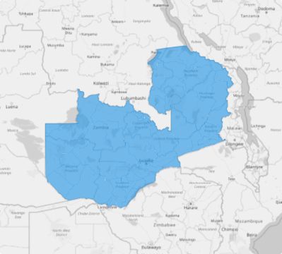
Lastly, click OK to start analyzing your map of Zambia districts.

GET NEW TERRITORY INSIGHTS
Dive into deeper insights as you apply these capabilities to your analysis:
- Group and sort data effortlessly for enhanced decision-making and operational efficiency
- Design revenue-focused sales territories to optimize performance
- Streamline your logistics with optimized routes


