SOUTH AFRICA PROVINCES
- Territory Guide
- SOUTH AFRICA PROVINCES
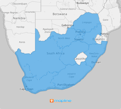
Take your business to new heights with the power of a map of South Africa provinces. By analyzing your performance at the provincial level, you can streamline operations and elevate your logistics management like never before. Imagine a map that not only outlines provincial boundaries but also gives you the vision to look beyond them. This level of strategic insight empowers you to identify opportunities, address challenges, and unlock your business’s full potential. Transform the way you operate and plan with a clearer, smarter approach!
Let’s unlock the full potential of your business by adding these administrative divisions to your map now!
WHAT ARE SOUTH AFRICA PROVINCES?
South Africa, located at the southern tip of Africa, is divided into nine provinces, each governed by a unicameral legislature. These legislatures are elected every five years through a party-list proportional representation system, ensuring that the political representation of each province reflects its diverse population. This system fosters inclusivity and equitable governance across the country.
Because of its unique local government and distinct characteristics, South Africa’s provinces provide a wealth of opportunities for strategic planning. By mapping these provinces, you can harness real-time data to craft more effective initiatives and pinpoint areas that have the greatest potential for impact. This comprehensive view allows you to focus your efforts where they matter most, boosting efficiency and driving stronger overall performance.
ADD SOUTH AFRICA PROVINCES
Take your business to new heights by turning detailed province-level insights into actionable strategies. Your map is more than a tool—it’s the key to unlocking your business’s full potential!
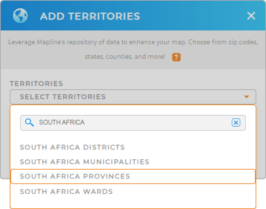
Let’s start adding a new territory from Mapline’s repository, shall we? First, utilize the search bar to type SOUTH AFRICA, then select SOUTH AFRICA PROVINCES.
Get ready—the next step is about to blow you away! Prepare to be amazed as you unlock even more powerful tools to transform your insights and elevate your strategy to a whole new level.


Pro Tip: Let Mapline’s Repository your optimum territory analytical partner for streamlining global logistics management. Integrate South Africa territories including South Africa districts, South Africa provinces, South Africa municipalities, and South Africa wards, to unlock the potential of your map to tailor your campaigns to align with the unique dynamics of each area.
CHOOSE PROVINCE COLORS
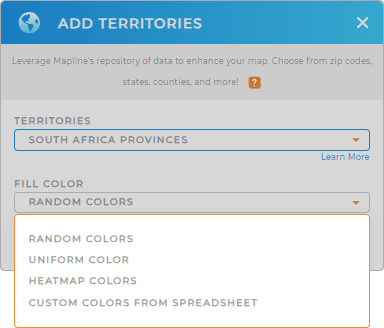
Bring your territories to life with the power of color! By color-coding areas on your map, you’ll unlock a whole new perspective to spot trends, uncover opportunities, and spark innovative strategies to boost sales. It’s not just about seeing the data—it’s about focusing on the regions that matter most and crafting a compelling story of your territory’s success.
With four vibrant color options at your fingertips, you can tailor your map to perfectly suit your analysis. Select the color styling option that aligns best with your goals, whether you’re highlighting trends, comparing regions, or identifying opportunities.

GET NEW TERRITORY INSIGHTS
With your map in tow, you can start extracting valuable insights using these capabilities:
- Visualize data within a specific geographic range to enhance operations and boost your success
- Run advanced calculations to extract hidden trends
- Group and sort your data to gain better insights and make smarter decisions


