SOUTH AFRICA DISTRICTS
- Territory Guide
- SOUTH AFRICA DISTRICTS
Elevate your business with strategic insights from a map of South Africa districts. Unlock the full potential of your business by diving deep into the power of a district map. Imagine analyzing your performance granularly, breaking through district boundaries to uncover hidden opportunities. This tool isn’t just a map—it’s a game-changer! With a clear understanding of each district’s unique dynamics, you can streamline your operations for seamless efficiency, optimize logistics management to cut costs and reduce delays, and pinpoint the perfect locations for distribution centers and warehouses, ensuring faster delivery and happier customers.
In just a few clicks, you can bring your district map into clear focus, ensuring your sales strategies are sharp, targeted, and highly effective. This streamlined approach helps you make smarter decisions and optimize your efforts for maximum impact.
WHAT ARE SOUTH AFRICA DISTRICTS?
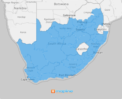
South Africa, the southernmost country on the African continent, is divided into nine provinces, each with its own distinct characteristics. These provinces are further divided into 52 districts, which serve as the second level of administrative division, positioned below the provinces and, in the case of district municipalities, above the local municipalities. Each district municipality is fully subdivided into local municipalities, creating a clear administrative hierarchy that helps streamline governance and regional management.
Plot district boundaries on your map and unlock endless possibilities! This powerful perspective lets you craft location-specific business plans, analyze district-level trends, optimize delivery routes, and so much more. Tailor your strategies to meet local needs, streamline your operations, and uncover new growth opportunities—all while maintaining a clear, detailed view that puts precision at the core of your decision-making.
ADD SOUTH AFRICA DISTRICTS
Unlock your business’s potential with South Africa districts on your map. Incorporating South Africa’s districts into your map doesn’t just enhance your analytics—it transforms them into a powerful tool for growth!
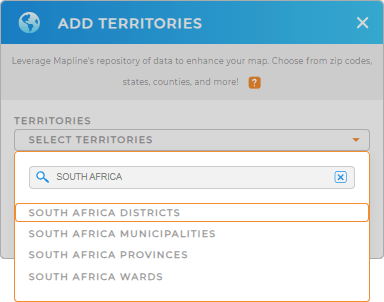
Let’s add a new territory from Mapline’s repository right away! Type SOUTH AFRICA to the search bar and select SOUTH AFRICA DISTRICTS.
Get ready to take your analysis to the next level and accelerate your decision-making! This next step will empower you to dive deeper, uncover insights faster, and make smarter moves with greater precision. Let’s move forward and supercharge your analysis!


Pro Tip: Mapline’s Repository is your partner in streamlining global logistics management. Integrate South Africa boundaries including South Africa districts, South Africa provinces, South Africa municipalities, and South Africa wards, to unlock the potential to optimize your operations with detailed regional insights.
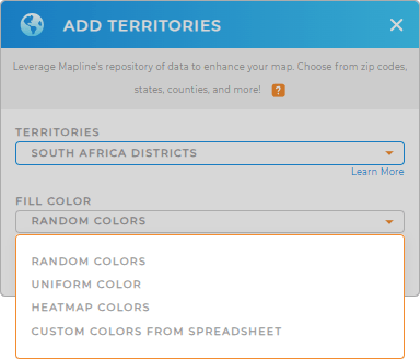
CHOOSE DISTRICT COLORS
Accelerate your insights with a color-coded map! Harness the power of colors to revolutionize your analysis. A color-coded map enables you to: Spot key areas at a glance. Uncover hidden trends. Let colors guide you to insights faster, saving time and improving accuracy.
Choose the perfect color styling option, depending on your analysis needs. Once you’re done configuring your color style settings, click OK.
Now, sit back, relax, and watch as your enhanced visualization unlocks valuable insights that will elevate your decision-making and drive business growth.

GET NEW TERRITORY INSIGHTS
When analyzing your data on your municipality map, you may want to apply these added capabilities to boost your analysis:
- Extract valuable insights from your data territories with folder reports
- Create eye-catching presentations with heat maps
- Add new charts to visualize snapshots of your data


