BELGIUM PROVINCES
- Territory Guide
- BELGIUM PROVINCES
Add Belgium provinces to your maps and transform your operations by tapping into precise insights into regional performance! By mapping these provinces, you can see exactly where your services are most in demand, helping you adjust your operations for maximum efficiency.
Whether you’re looking to streamline delivery routes or identify regions needing more attention, mapping Belgium provinces is a game-changer. Get ready to supercharge your logistics strategy with actionable data insights and take your business to the next level!
WHAT ARE BELGIUM PROVINCES?
Belgium is divided into 10 provinces, which are the main regional divisions within the country, similar to states in the USA. Each of these provinces has its own unique characteristics and administrative functions.
Leveraging a map of Belgium provinces can help your logistics team focus on specific areas, identify bottlenecks in delivery routes, and ensure timely deliveries. By visualizing these regions, you can prioritize tasks and optimize your daily operations. Mapping Belgium provinces provides you with the tools to stay ahead of potential issues and keep your business running smoothly.
ADD BELGIUM PROVINCES
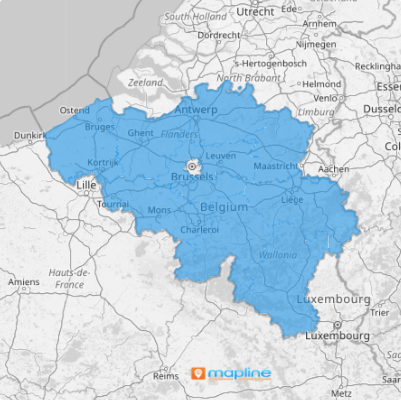
Unlock Belgium’s full potential with a dynamic province map that brings local insights to your fingertips. Adding Belgium provinces to your map allows you to better organize and manage your logistics operations by giving you a clear view of regional performance.
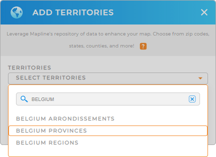
First, add a new territory from Mapline’s repository, type BELGIUM into the search bar, and select BELGIUM PROVINCES. This is a fast, easy way to add precise government boundaries to your map!


Pro Tip: Mapline’s extensive list of territory boundaries enables you to add Belgium arrondissements, Belgium regions, and provinces to your map, opening up a world of possibilities for global logistics management. Experiment with different territories to find the best combination for your business needs and stay ahead in your industry.
CHOOSE PROVINCE COLORS
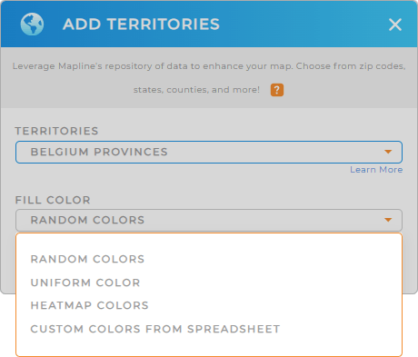
Color-coding your Belgium provinces is essential for clear and quick data visualization. By assigning different colors to each province, you can easily spot regional trends, track performance, and optimize your operations. Select your desired color styling, then click OK.
Woah! You just enhanced the power of your map, making it easier to analyze data at a glance and make informed decisions! How cool is that?

GET NEW TERRITORY INSIGHTS
Unlock more valuable insights that were previously hidden in your data by using these powerful capabilities:
- Identify areas with delayed deliveries and address root causes to improve service
- Track vehicle usage and maintenance needs across different provinces to optimize fleet management
- Analyze customer feedback from different regions to tailor services and enhance satisfaction


