AUSTRALIA STATISTICAL AREAS
- Territory Guide
- AUSTRALIA STATISTICAL AREAS
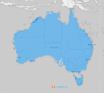
Enhance your map with Australia statistical areas and watch insights come to life. By diving into this detailed level, these boundaries become your gateway to unlocking invaluable information. Imagine pinpointing exactly where to channel your efforts, customizing strategies for specific areas, and gaining a deep understanding of market dynamics. This analytical approach allows you to move beyond surface-level analysis, empowering you to craft strategies that are not just informed but laser-focused and impactful.
Ready to take the leap? Your next big breakthrough is waiting—just a map away!
WHAT ARE AUSTRALIA STATISTICAL AREAS?
The Australian Statistical Geography Standard (ASGS) is a modern framework that organizes Australia into a hierarchy of statistical areas, providing a clear lens to view the nation’s dynamic social geography. Designed to map where people and communities live, the ASGS is the backbone for releasing and analyzing vital statistics and data. Reflecting Australia’s ever-evolving population, economy, and infrastructure, the ASGS undergoes updates every five years, ensuring it remains a precise and relevant tool for understanding the country’s growth and transformation.
Successful brands operating in Australia thrive by embracing the insights found at the statistical area level. This level of analytical precision uncovers valuable insights that propel their strategies to new heights.
ADD STATISTICAL AREAS
Now let’s embark on this quick adventure of adding this territory to your map. This detailed approach can reveal hidden patterns that lead to discovering new insights. Imagine being able to design strategies that are relatable to the local market!
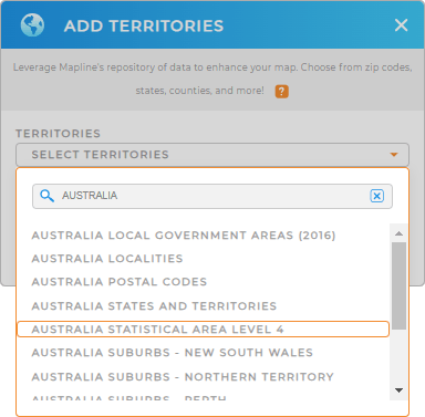
Boost your business growth like never before! Start by adding a new territory from Mapline’s repository. In the search bar, type AUSTRALIA and choose AUSTRALIA STATISTICAL AREAS from the drop-down menu.
That simplifies the process.


Pro Tip: Mapline’s global territory repository lets you add detailed administrative boundaries of Australia to your map in seconds. That include Australia local government areas, Australia localities, Australia postal codes, Australia states and territories, Australia statistical areas, and Australia suburbs. Explore these territories to get sharper insights to enhance your business strategies.
CHOOSE STATISTICAL AREA COLORS
Make your map a blueprint for your success by adding colors. Transform complex data into clear, actionable strategies with colors. Colors are vibrant, visually intuitive tools that empower you to come up with smart decisions and unlock opportunities at just a glance.
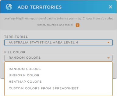
Ready to unlock the potential of a color-coded map and watch your business thrive? Just choose a color styling option that’s perfect for your analysis. Once you’ve configured your settings, click OK.

GET NEW TERRITORY INSIGHTS
Maximize the potential of your map of Australia statistical areas by applying these advanced capabilities:
- Create a cohesive plan to track events in your industry
- Streamline your bid management process to enhance your professional image
- Utilize folder reports to analyze performance by statistical area


