IRELAND ELECTORAL DIVISIONS
- Territory Guide
- IRELAND ELECTORAL DIVISIONS
Add Ireland Electoral Divisions to your map and uncover deeper insights into the country’s diverse market landscape! With Mapline’s powerful mapping tools, you can seamlessly integrate these boundaries into your analysis, giving you a granular understanding of local markets. But why stop there? Explore how Mapline also lets you incorporate these distinct boundaries into your map, enabling you to optimize sales territories, enhance logistical operations, and target markets with precision.
Ready to get started? Let’s dive in and discover how this map can be so powerful that you can transform your data into actionable strategies that drive growth and efficiency!
WHAT ARE IRELAND ELECTORAL DIVISIONS?
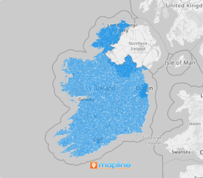
Ireland, a picturesque island in the North Atlantic, sits in the heart of northwestern Europe. The country is organized into 166 local electoral divisions—legally defined areas made up of multiple townlands, once part of urban and rural district subdivisions.
These electoral divisions offer a window into local dynamics, making them invaluable for businesses seeking growth. By visualizing customer presence, market conditions, and competitive landscapes at this granular level, successful brands uncover the best opportunities to expand. With these insights, you can pinpoint ideal locations, fine-tune strategies, and thrive in Ireland’s diverse and dynamic marketplace.
ADD IRELAND ELECTORAL DIVISIONS
Unlock insights at a glance and transform them into impactful strategies by adding these electoral division boundaries to your map. This powerful map can help you identify patterns, uncover hidden opportunities, and make smarter decisions.
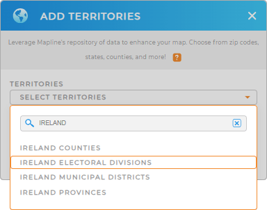
Add a new territory from Mapline’s repository and be amazed by the awesome results! Type IRELAND in the search bar to trim down the selections. Then, select IRELAND ELECTORAL DIVISIONS.
We’re done with Step 1, let’s quickly move on to the next part.


Pro Tip: Explore Ireland territories, including electoral divisions, Ireland municipal districts, Ireland counties, and Ireland provinces, in Mapline’s territory boundaries. Discover the best approach to elevate your business strategies and expand your global operational reach.
CHOOSE DIVISION COLORS
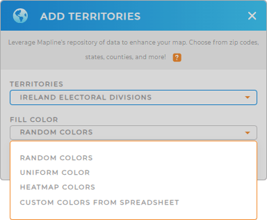
Now let’s add some colors. Color-coded territories are your gateway to faster, deeper insights! By visually distinguishing each division boundary, you can quickly analyze their strengths and opportunities, enabling you to pinpoint trends that directly impact your brand.
Mapline provides powerful color styles to let you grasp the most insights from your analysis. Choose from heat map, custom colors, uniform or random colors. Then, click OK.

GET NEW TERRITORY INSIGHTS
Discover more insights as you apply these powerful capabilities:
- Open the folder report to delve deeper into your data
- Create a powerful system that auto-calculates your market share
- Add demographic data to analyze regional markets


