U.S. STATE ASSEMBLY DISTRICTS
- Territory Guide
- U.S. STATE ASSEMBLY DISTRICTS
A map showing a U.S. State Assembly Districts is an excellent way to derive localized decision-making. By understanding the dynamics at this level, you can tailor your marketing strategies, product offerings, or customer engagement efforts to meet the specific needs of each area. This localized approach leads to more effective, targeted campaigns. Imagine having the ability to track patterns and trends that influence your business decisions! That’s just wow!
Get ready to supercharge your analysis as you map out your success starting with creating this territory map!
WHAT ARE U.S. STATE ASSEMBLY DISTRICTS?
The New York State Assembly, the lower house of the New York State Legislature, is a dynamic body comprising 150 seats. Tasked with shaping policy and legislation, the Assembly oversees a wide range of committees, including consumer affairs and protection, economic development, job creation, commerce, and industry.
Now, imagine harnessing the power of a New York Assembly district map to revolutionize your operations. Plot your data alongside assembly district boundaries to unlock powerful visualizations that elevate your decision-making process. Whether it’s reducing delivery times, optimizing routes, or streamlining resource allocation, this level of mapping transforms your logistics strategies into precision-driven success.
ADD U.S. STATE ASSEMBLY DISTRICTS
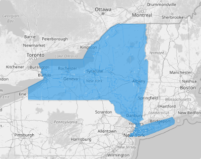
Add these district boundaries to your map in seconds to instantly visualize key patterns and relationships that would otherwise take hours or even days to uncover. Analyzing at this level leads to identifying market trends at a hyper-local level.
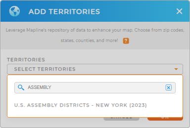
With a few clicks, you can add a new territory from Mapline’s Repository. Type the keyword ASSEMBLY and select U.S. ASSEMBLY DISTRICTS – NEW YORK.
How convenient is that!


Pro Tip: Mapline’s repository offers a territory map of New York State Assembly Districts. Maximize the use of this map to visualize data with precision and accuracy.
CHOOSE ASSEMBLY DISTRICT COLORS
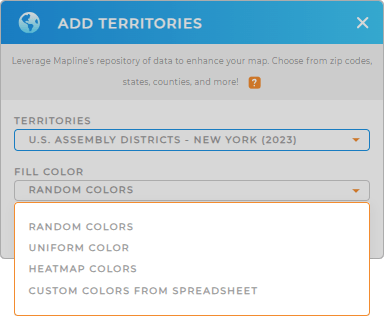
You can reap more insights on your map as you apply colors. Colors help drive business growth. This tool is very reliable in identifying key areas for marketing. For instance, when you apply heat map colors, you can identify areas with high customer activity, allowing you to focus more marketing efforts in those regions. How cool is that!
Color-code your territory with Mapline’s color styling options. Choose the type of colors that help you achieve your goals. Then, click OK.

GET NEW TERRITORY INSIGHTS
Apply these helpful capabilities to transform your map into a powerful tool for analysis:
- Create a chart that shows a snapshot of changing data
- Leverage advanced route optimization
- Seamlessly create custom sales territories


