FEDERALLY RECOGNIZED TRIBAL LANDS
- Territory Guide
- FEDERALLY RECOGNIZED TRIBAL LANDS
A detailed map of Federally Recognized Tribal Lands is more than a tool—it’s your gateway to unlocking regional dynamics and supercharging your strategies with pinpoint accuracy. With data-driven insights, you can identify ideal markets for expansion and uncover untapped investment opportunities. By visualizing your business perspectives within these well-defined boundaries, you’ll transform complex patterns into clear, actionable pathways to success. Understanding your market at this level allows you to tailor your marketing strategies, product offerings, or customer engagement efforts to meet the specific needs of each area. This localized approach leads to more effective, targeted campaigns.
Let’s add these boundaries quickly to your map and gain valuable insights instantly!
WHAT ARE FEDERALLY RECOGNIZED TRIBAL LANDS?
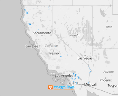
California is home to 109 federally recognized Indian tribes, many of which have lands that span across state boundaries. These tribes and communities are woven into the fabric of California. To truly understand these dynamics, a detailed map of Federally Recognized Tribal Lands is indispensable. This map goes beyond geography—it’s a gateway to dissecting regional trends, uncovering target markets, and identifying investment opportunities.
By visualizing these precise boundaries of tribal lands, complex patterns transform into actionable insights, enabling you to make informed decisions with clarity and confidence.
ADD FEDERALLY RECOGNIZED TRIBAL LANDS
Add this territory to your map today and unlock the insights you need for smarter, localized decision-making. Tribal land analysis empowers you to base decisions on local dynamics rather than sweeping regional trends, giving you a sharper focus on the unique characteristics of each area.
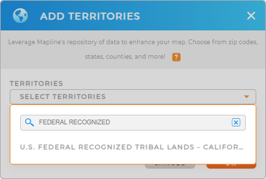
To swiftly add a new territory from Mapline’s Repository, type FEDERAL RECOGNIZED and you will be directed to click on FEDERAL RECOGNIZED TRIBAL LANDS.


Pro Tip: Looking for special territories like Federally Recognized Tribal Lands in California? Don’t worry–Mapline’s Repository got your back! Leverage this territory and be empowered by the insights you’ll gain for localized decision-making.
CHOOSE TRIBAL LAND COLORS
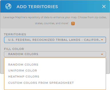
Turn your map into an easy-to-read, visually engaging resource with colors. Assign specific colors to each boundary for instant clarity, especially when comparing multiple regions. For deeper insights, apply dynamic colors that adjust based on your data. This approach makes it effortless to identify high-performing areas and pinpoint those requiring attention—all at a glance.
Choose the color styles that best suit your analysis to reap the best insights. Then. click OK.

GET NEW TERRITORY INSIGHTS
Tap into dynamic, in-depth consumer insights with these capabilities:
- Get an overview of your competitors to understand your market position
- Optimize routes efficiently to reduce costs
- Master market mapping to analyze your customers in minutes


