U.K. LOCAL AUTHORITY DISTRICTS
- Territory Guide
- U.K. LOCAL AUTHORITY DISTRICTS
Unlock your business growth as you leverage a map of U.K. Local Authority Districts. This distinct map can transform your approach and help you visualize regional insights. Seamlessly integrate local government area boundaries to uncover trends and opportunities within specific districts. With LAD boundaries on your map, you gain the power to make data-driven, location-focused decisions that drive success. Whether you’re planning your next campaign, optimizing resources, or expanding into new markets, location insights are your key to unlocking growth.
Let’s dive in and see how mapping solutions can empower your business to stay ahead of the curve!
WHAT ARE U.K. LOCAL AUTHORITY DISTRICTS?
Local Authority Districts (LADs) are the backbone of local governance in the United Kingdom, each playing a vital role in shaping communities and delivering essential services. With 374 districts in total, they’re as diverse as the regions they serve:
- 181 Non-Metropolitan Districts: Known as “shire districts,” these are the most common type, with populations ranging from 25,000 to 200,000
- 81 Unitary Authorities: These single-tier councils handle all local government services in their areas, offering streamlined administration
- 36 Metropolitan Districts: Found in the six metropolitan counties, these councils oversee key services like education, social care, waste collection, and transport infrastructure
- 33 London Boroughs: The administrative heart of Greater London, each governed by its own borough council
- 32 Council Areas: Defined for cultural and geographical purposes, reflecting the rich diversity of the U.K.
- 11 Local Government Districts: Serving as the primary administrative divisions in certain areas
Mapping these districts opens the door to powerful insights and smarter strategies.
ADD U.K. LOCAL AUTHORITY DISTRICTS
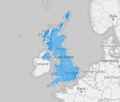
Enhance your strategic decision-making by adding U.K. Local Authority Districts (LADs) to your map. These districts provide a crucial framework for understanding regional demographics, market potential, and distribution networks, enabling you to visualize opportunities like never before.
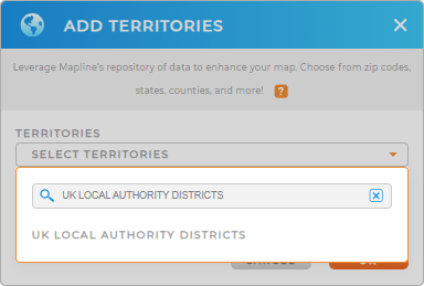
Unlock the power of Local Authority Districts in the U.K. as you add a new territory from Mapline’s repository. Type UK LOCAL AUTHORITY DISTRICTS to quickly add this territory to your map.


Pro Tip: Tap into Mapline’s global territory repository to gain valuable insights from territory mapping. Leverage a map of U.K. Local Authority Districts in your analytics and discover insights significant for business operations.
CHOOSE LOCAL AUTHORITY DISTRICT COLORS
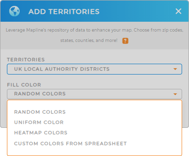
Supercharge your strategy with a color-coded map. By using colors as visual representations of customer density, sales performance, or market penetration, you can instantly identify key insights at a glance. How awesome is that?
Whether you’re applying static or dynamic colors tied to your data, Mapline has you covered with the best color styling options.
Now, you can unlock the full potential of your map!

GET NEW TERRITORY INSIGHTS
Now, it’s time to unlock the full power of your map! Get started with some of these useful capabilities:
- Unlock insights as you visualize trends and patterns
- Manage all of your operations in one collaborative platform
- Filter your data to focus your analysis on one particular area


