VENEZUELA MUNICIPALITIES
- Territory Guide
- VENEZUELA MUNICIPALITIES
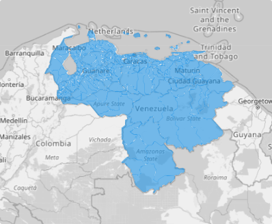
Supercharge your strategy with a map of Venezuela municipalities! This game-changing analytical tool can transform your approach to business operations. Visualizing distinct district boundaries significantly helps to segment your customers seamlessly. Watch as your business perspectives align seamlessly with municipality locations, revealing actionable insights. Transform customer segmentation with precise geographic insights for targeted strategies.
Adding municipality boundaries is faster than a speeding bullet—you’ll be up and running in minutes! Say goodbye to guesswork and hello to data-driven success as you reshape your operations with precision.
WHAT ARE VENEZUELA MUNICIPALITIES?
Located on the northern coast of South America, Venezuela spans a vast continental landmass and a scattering of islands in the Caribbean Sea. Its 23 states and the Capital District are divided into 335 municipalities, each offering a unique blend of opportunities and challenges.
Understanding the nuances of these municipalities isn’t just beneficial—it’s transformative. By leveraging regional insights, you can unlock a deeper understanding of customer dynamics, giving your business a competitive edge that sets you apart.
ADD VENEZUELA MUNICIPALITIES
Take your business operations to superhero levels as you add these boundaries to your map! With a focused, municipality-level approach, you’ll be able to deliver exceptional results that set your business apart.
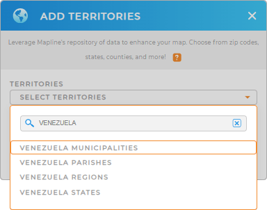
In just a few clicks, you can add municipality boundaries to your map, unlocking the power to visualize your data like never before. Just add a new territory from Mapline’s repository. Use the search bar to type VENEZUELA and select VENEZUELA MUNICIPALITIES.


Pro Tip: Take advantage of Mapline’s global territory repository to unlock powerful new insights. It provides different territories from Venezuela including Venezuela states, Venezuela regions, Venezuela parishes, and municipalities. Create customized Venezuela territory maps to analyze and optimize your operations!
CHOOSE MUNICIPALITY COLORS
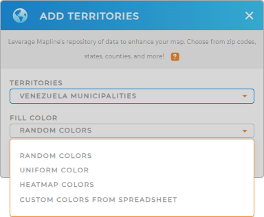
Navigate more opportunities as you apply colors in municipal boundaries. Colors are a vital tool for more powerful visualization. A color-coded map brings you instant clarity so you can quickly distinguish between municipalities and identify key trends with a visual representation of your data.
Choose your preferred color styles to capture hyper-focused insights with remarkable clarity, allowing you to make smarter, data-driven decisions.

GET NEW TERRITORY INSIGHTS
Make room in your analytical tool for these powerful capabilities to enhance your analysis:
- Automate your tasks to ensure flawless operations
- Manage sales territories of any size in just a few clicks
- Spot opportunities within a 20-mile radius at a glance


