- Blog
- Geo Mapping
- POSTCODE MAPPING SOFTWARE: FREE VS. PAID TOOLS
Post code mapping is one of the most underrated tools in business strategy. Whether you’re analyzing sales regions, mapping customer clusters, or evaluating delivery zones, the ability to visualize data by postal code gives your team a clear geographic edge. But when it comes to choosing a tool, there’s one big question: can you get powerful post code mapping for free?
The short answer: kind of. Not all mapping tools are created equal—and “free” doesn’t always mean functional. Let’s explore the real difference between free postcode mapping tools and professional solutions built for businesses.
What Is Post Code Mapping—and Why It Matters
Post code mapping allows users to visualize locations, territories, and data grouped by postal zones—whether that’s ZIP codes in the U.S., postcodes in the UK, or FSAs in Canada. From sales territories to service areas, this type of mapping helps businesses make location-based decisions with clarity.
With a postcode mapping tool, you can:
- Visualize customer or sales data by location
- Draw boundaries based on postal zones
- Group regions by rep, volume, or performance
Compared to spreadsheets or CRMs, a zip code mapping tool gives you instant geographic insight—without digging through raw data.
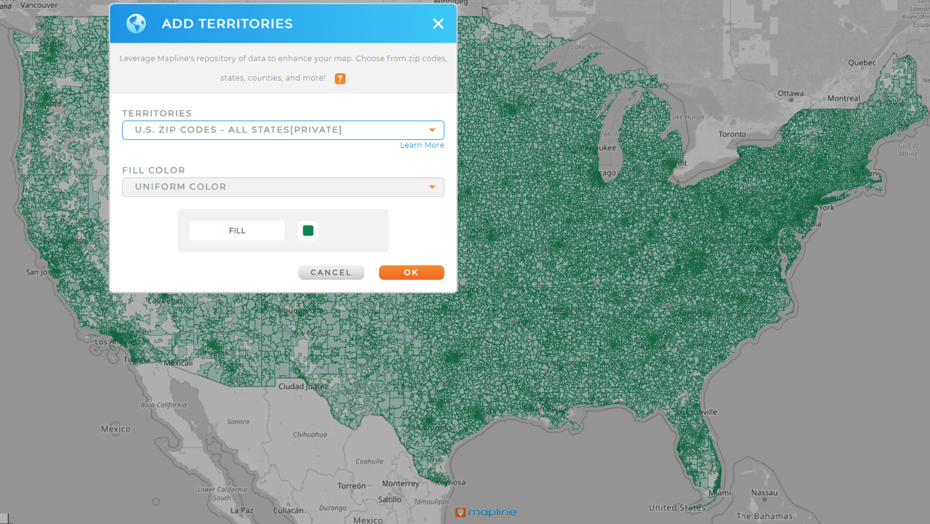

Pro Tip: Need to map ZIP codes by sales, delivery zone, or customer type? Create your first interactive map with Mapline’s Mapping Starter plan—no credit card required. It’s everything you need to move from spreadsheet to strategy in seconds.
Free Post Code Mapping Tools: What You Get (and What You Don’t)
Free zip code mapping tools sound great—until you hit their limits. While many free versions allow basic plotting, they’re often missing the features that actually make mapping useful for business.
Common limitations include:
- Data row limits (usually 250–500)
- No custom pin styles or filtering
- Limited export or share features
- No routing, dashboards, or saved territories
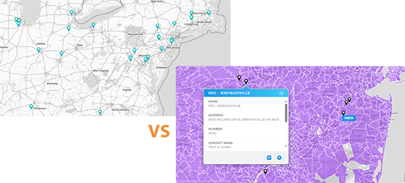
Interactive postcode maps are especially limited when they’re browser-based. Without interactivity or smart filtering, you’re just looking at static points—not getting strategic answers.
| Tool | Free ZIP Code Mapping | How It Works | Key Limitations |
|---|---|---|---|
| Mapline | Yes (via Mapping Starter plan) | Upload a spreadsheet with ZIP codes to generate a pin map. No credit card or download required to start. | Up to 500 rows (250 per dataset). Territory and styling tools require upgrade. |
| Easy Map Maker | Yes | Paste ZIPs or upload a CSV to generate a simple pin map preview. | 250-row limit; lacks territories and interactivity. |
| Maptive | Trial Only | Limited free trial includes ZIP code mapping and basic visuals. | Requires paid plan to save, share, or unlock full features. |
| BatchGeo | Yes | Upload addresses or ZIP codes to create a basic map view. | No routing, dashboards, or territory creation tools. |
| Caliper (Maptitude) | No | Desktop-only paid software; no free trial or online version. | No access without purchase; designed for desktop GIS users. |
Free Mapping Features (Mapping Starter)
If you need to get pins on a map fast, the Mapping Starter delivers. It’s built for users who want to upload spreadsheet data, visualize location-based insights, and share results—without spending a dime. With Mapline’s Mapping Starter, there’s no need for complex setup, technical skills, or expensive software. It’s a straightforward, visual-first way to turn raw location data into something useful. And if you decide you need more power later, you can upgrade anytime.
Plot Pins Instantly from a Spreadsheet
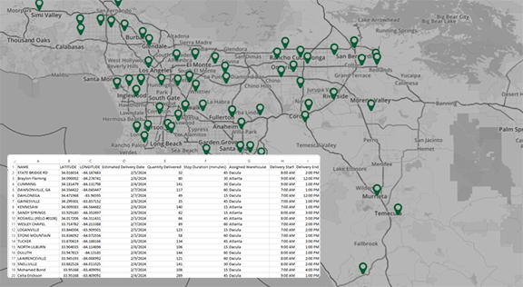
Just upload an Excel or CSV file and your locations appear on the map—no coding, no formulas, no special formatting. Whether you’re mapping customer addresses, store locations, or sales leads, pins populate automatically. It’s the fastest way to bring your location data to life.
Draw Custom Territories
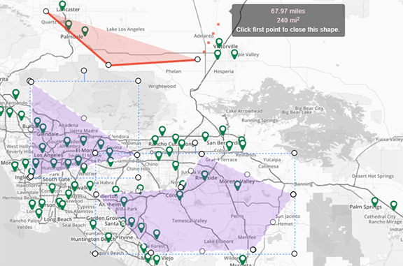
Need to see which ZIP codes or counties your pins fall into? You can overlay basic boundary shapes like states or ZIP codes to get a quick visual of your coverage. This helps with territory awareness, even if you’re not managing formal sales regions yet.
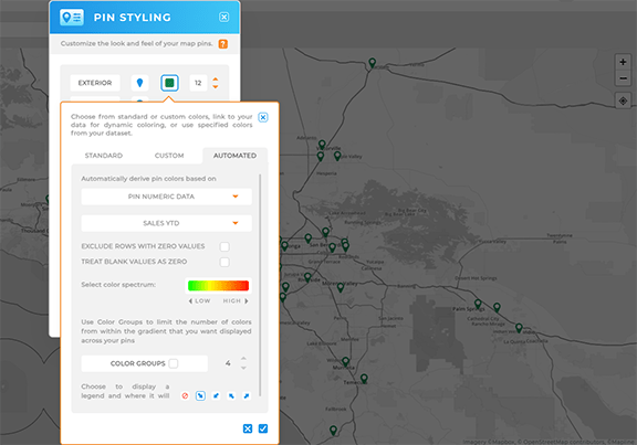
Customize Pins by Color and Category
You can assign pin colors based on regions, statuses, or reps. This gives your map immediate clarity—no need to decode a spreadsheet to understand what you’re seeing. It’s a quick way to spot trends or outliers.
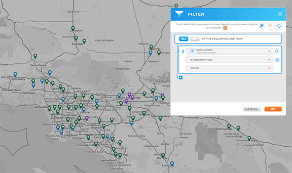
Filter, Segment, and Drill Into Data
Geo Mapping goes beyond visualization. Apply live filters to show or hide pins by rep, region, product line, or status. Segment your data by territory, and drill down into what’s happening—whether it’s performance gaps, customer clusters, or coverage blind spots. It’s all done in a few clicks.
Share or Embed Your Map Anywhere
When you’re ready to show off your map, you can share it via a live link or embed it in a website or report. No downloads or installations required. Your map stays synced and accessible to anyone you share it with.

What Paid Post Code Mapping Software Unlocks
When your team needs more than just dots on a map, paid tools offer the horsepower to scale. A postcode mapping tool like Mapline unlocks high-volume insight, location intelligence, and built-in collaboration.
With Mapline’s Geo Mapping, you can:
- Create a postcode heat map to visualize performance density
- Draw overlapping or exclusive sales territories
- Filter regions by customer type, performance, or rep
- Build dashboards with real-time sync to your data source
- Export high-res maps, embed in presentations, or share links live
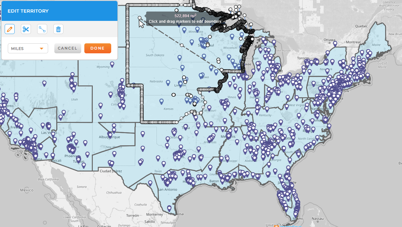
Mapline’s paid tools are built for growth—which means you can scale from a single territory to thousands of data points, and still see it all at a glance.

Pro Tip: Geo Mapping is the world’s most powerful mapping software! Instantly plot locations, overlay any territory from Mapline’s global boundary repository, and unlock powerful visual insights in seconds. Whether you’re mapping sales regions, analyzing ZIP code data, or building custom areas for market planning, Geo Mapping delivers unmatched speed, clarity, and control—no GIS experience required.
Country-Specific Post Code Mapping Tools
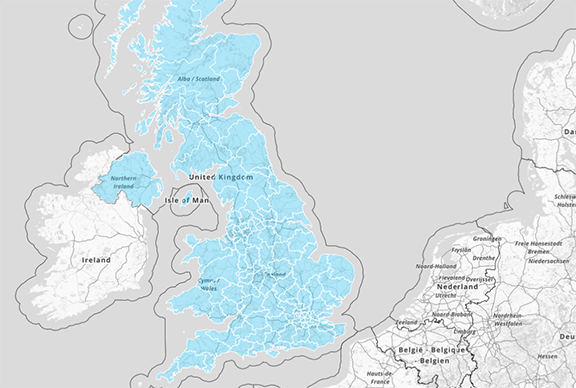
Whether you’re in the U.S., Canada, or the U.K., postal formats vary—but the need for postcode mapping remains universal. Mapline supports global postal code systems with full interactivity and precision.
Available regional mapping includes:
Need to map multiple countries? You can mix and match regions in a single map—no need to start over when expanding territories.
Post Code Mapping Tools: Free vs Paid Comparison
Here’s how the most popular postcode mapping platforms stack up:
| Tool | Free Version? | Max Rows | Pin Mapping | Territories | Interactivity | Routing |
|---|---|---|---|---|---|---|
| Mapline | Yes (Mapping Starter) | 500 (250 per dataset) | Yes | Yes | Yes | Yes (Up to 5 routes, 10 stops each) |
| Easy Map Maker | Yes | 250 | Yes | No | No | Yes (Up to 20 stops) |
| Maptive | Trial Only | 250 | Yes | Yes (Paid) | Limited | Yes (Up to 25 locations) |
| Caliper (Maptitude) | No | N/A | Yes | Yes | Yes | N/A |
GEO MAPPING— THE WORLD’S MOST POWERFUL MAPPING PLATFORM
Geo Mapping is built for teams that need serious control, performance, and visibility. It’s Mapline’s most powerful mapping tool, designed for fast, intelligent analysis of thousands of locations across dynamic territories. Whether you’re managing a sales force, allocating service areas, or evaluating market coverage, Geo Mapping delivers unmatched precision. It’s not just about maps—it’s about smarter strategy.
Unlock a Global Library of Territories
With access to Mapline’s worldwide boundary repository, you can layer ZIP codes, districts, countries, sales regions, and more—instantly. There’s no manual drawing or shape importing. Just choose what you need and go. This lets you build highly customized views in seconds.
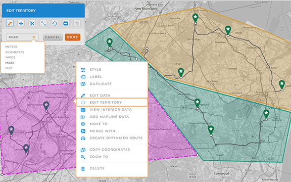
Edit and Combine Territories On the Fly
Unlike rigid mapping tools, Geo Mapping lets you merge, split, and modify boundaries to match your internal operations. Create custom sales territories, service zones, or strategic areas based on real-world needs—not preset shapes. This keeps your maps aligned with your actual business logic.
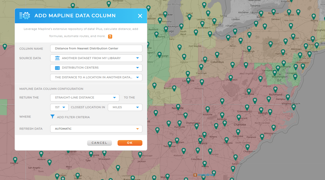
Run Distance Calculations Without Writing a Formula
Geo Mapping lets you instantly calculate distances between pins, ZIP codes, or territories using Mapline’s built-in logic. No need to export data, use Excel, or do math manually. Want to see how far a customer is from the nearest warehouse? Or calculate average distance from your top 10 accounts to a regional hub? Just click. It’s built for non-technical teams who still need precision.
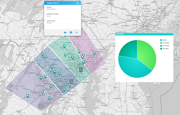
Enhance Your Maps with Demographic and Location Intelligence
Only Geo Mapping gives you access to layered data like population density, income levels, and business types—built right into the platform. This turns your standard map into a real strategic asset. Overlay demographic data to assess market potential, plan service zones, or identify underserved regions. It’s like getting an instant market analysis tool, built into your mapping engine.
Final Thoughts: Choosing the Right Post Code Mapping Tool
If you’re just plotting a handful of locations, a free postcode map might get the job done. But if you’re managing field teams, analyzing regional sales, or optimizing delivery zones, you need a tool built for the real world.
Mapline gives you interactive postcode maps, routing, territories, dashboards, and more—without requiring a GIS background. And with the free Mapping Starter plan, you can start mapping smarter in minutes.
Yes—but free tools are typically limited in scope. Most cap your data rows, don’t allow territory drawing, and lack routing or interactivity. Mapline’s free plan lets you try basic features with up to 500 rows.
“ZIP code” is the U.S. version of a postal code. Outside the U.S., they’re often called “postcodes” (UK, Canada, etc.). Both serve the same purpose for sorting regions geographically.
Mapline is purpose-built for business teams. It’s fast, flexible, and designed to scale with your data.
Heat maps help you visualize data intensity by region—perfect for spotting sales clusters, delivery bottlenecks, or high-volume territories.


