CANADA FORWARD SORTATION AREAS
- Territory Guide
- CANADA FORWARD SORTATION AREAS
Add Canada Forward Sortation Areas (FSAs) to your map and leverage territory boundaries beyond provinces, urban areas, and rural regions. Keep up with the latest trends and activities, analyze key market data, and quickly visualize the factors impacting your operations.
By visualizing your data with Forward Sortation Areas, you can uncover hidden insights and drive smarter decision-making. Let’s dive in and elevate your business strategy.
WHAT ARE CANADA FORWARD SORTATION AREAS (FSAs)?
Canada Forward Sortation Areas (FSAs) are geographic regions represented by the first three characters of a postal code. These areas help Canadian postal workers understand which province or territory a piece of mail should be delivered to. Each FSA covers several neighborhoods or communities, making it a vital unit for regional planning and analysis.
Leveraging a map of these FSAs can help you strategically plan and execute initiatives. Mapping these territories provides precision and clarity, ensuring that you and your team focus on the metrics that count.
ADD FSAs TO MAP
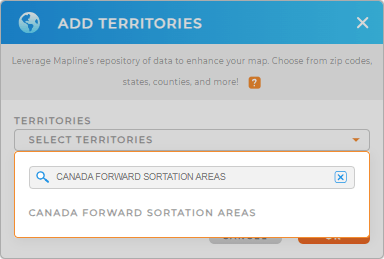
Level-up your data analysis and add Canada FSAs to your map in seconds! First, add a new territory from Mapline’s repository. Type CANADA in the searchbar and select CANADA FORWARD SORTATION AREAS.
And BOOM! That’s all it takes. Now, let’s finalize your territory options, and you’ll be good to go.


Pro Tip: With access to Mapline’s vast territory repository, you can quickly add different regions to your map, such as Canada provinces, population centres, or census tracts. Unlock new opportunities and craft data-driven strategies by analyzing the impact of different types of territories on your operations.
CHOOSE FSA COLORS
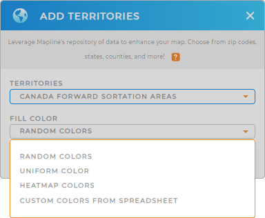
Now, let’s transform your data into a visual powerhouse. Choose your preferred color styles so you can quickly spot trends, optimize operations, and identify areas of improvement.
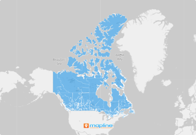
When you’re done, click OK. Now your map is ready to analyze!

GET NEW TERRITORY INSIGHTS
See how easy it can get to build your own map of Canada forward sortation areas? But it doesn’t stop there! Your territory map is a dynamic powerhouse for leveling-up your business strategies. Now, you can:
- Segment your audience to reveal customer trends
- Leverage heat maps to analyze market density and reach
- Run advanced distance calculations to identify the impact of location on sales


