CENTRAL AFRICAN REPUBLIC PREFECTURES
- Territory Guide
- CENTRAL AFRICAN REPUBLIC PREFECTURES
Harness the power of a map of Central African Republic prefectures and initiate an exceptional transformation in your business analysis. Focusing on prefectures offers a granular approach, revealing hyper-local insights that lead to smarter decision-making. Since prefectures are smaller, they allow you to dig deeper, uncovering both challenges and opportunities with the precision that broader maps can’t provide. This detailed view allows you to tailor your marketing efforts, adjust sales tactics, and align operations to the specific needs and dynamics of each area.
Create a prefecture map now and unlock a treasure trove of insights that help you refine and optimize business strategies! It’s a game-changer that elevates your business strategy to new heights, fueling growth and efficiency like never before.
WHAT ARE CENTRAL AFRICAN REPUBLIC PREFECTURES?
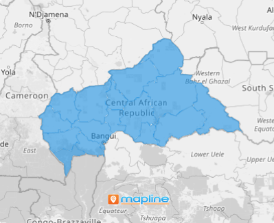
Central African Republic (CAR) is a landlocked gem in the heart of Africa! Once known as Ubangi-Shari, CAR may be small on the map, but it’s bursting with character. Imagine this: it’s about the size of Texas, yet four times larger than the state of Georgia! The country is organized into 20 prefectures, each one named after the mighty rivers flowing through them, and at its center lies the vibrant capital city, Bangui —an autonomous commune with a character all its own. Each of these prefectures has its own local assembly, known as the General Council, led by a Prefect who keeps things running smoothly. Two of these prefectures are even designated as economic zones, highlighting the country’s strategic importance in the region.
Uncovering the hidden potential of the Central African Republic (CAR) begins with mapping its prefectures. Partnering with Mapline allows you to dive deep into prefecture-level analysis, revealing insights that can unlock new development opportunities for your business.
ADD CAR PREFECTURES
Unlock the full potential of your Central African Republic (CAR) prefecture map and take your analysis to the next level! Mapping the prefectures with precision allows you to visualize spatial distribution like never before. Whether you’re tracking sales, customer behavior, or demographic shifts, this approach provides hyper-local insights that can shape smarter decisions.
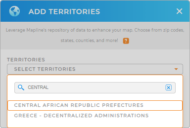
To start your prefecture-level mapping, easily add a new territory from Mapline’s repository. Type even just the keyword CENTRAL in the search bar to quickly locate CENTRAL AFRICAN REPUBLIC PREFECTURES and add to your map.
One last step and we’re done.


Pro Tip: Make Mapline’s territory repository an invaluable part of your analytical toolkit for getting the most out of territory insights. It provides an array of territories including Central African Republic prefectures. Add different territory boundaries including Madagascar Provinces, Zimbabwe Districts, or Algeria Municipalities to your map in seconds to develop a global strategy for your business.
CHOOSE PREFECTURE COLORS
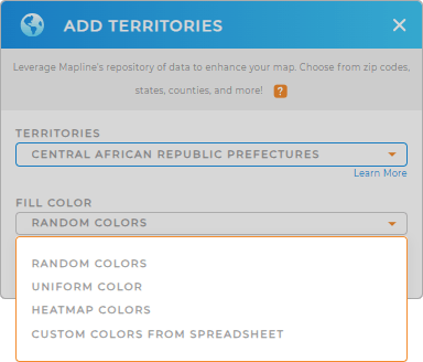
Now, accelerate your analysis by applying colors to your prefecture territory map, transforming into a vivid visual story. By assigning different colors to each prefecture, patterns become instantly recognizable, allowing you to spot trends, disparities, or areas of opportunity at a glance.
Choose the color styling option that best provide clarity and impact in your analysis – one that will help you turn your complex data into easy-to-understand visuals that lead to smarter strategies and more effective planning.
With your color-coded map of Central African Republic prefectures, decision-making becomes more faster, sharper, and more intuitive!

GET NEW TERRITORY INSIGHTS
Be more ready to identify all the factors affecting your business when you leverage these powerful capabilities:
- Calculate key metrics to analyze market saturation
- Configure your territories to get the exact insights you’re looking for
- Optimize trip planning to cut down on travel time


