DJIBOUTI REGIONS
- Territory Guide
- DJIBOUTI REGIONS
Elevate your territory management game by mapping out Djibouti regions with precision and clarity! Bring your territory plans to life by visualizing key insights within defined regional boundaries! Watch as trends, challenges, and opportunities unfold right before your eyes. Transform these insights into action by leveraging your region map to create location-smart territories that drive efficiency, optimize resources, and boost performance.
Get ready to manage your territories like never before!
WHAT ARE DJIBOUTI REGIONS?
Djibouti, a strategic country in the Horn of Africa, is divided into six administrative regions, including Djibouti City, which lies on the Gulf of Tadjoura. By closely analyzing the boundaries of these regions, brands can uncover key factors to shape effective territory plans that drive business success. A detailed region territory map provides a deeper perspective when defining market areas and spotting growth opportunities.
Analyzing these regions empowers you to gain valuable insights into localized market trends. This approach helps you seamlessly understand customer demographics, monitor competitive landscapes, and make data-driven decisions. With these insights, you can fine-tune your strategy, optimize resource allocation, and position your brand for growth!
ADD DJIBOUTI REGIONS
Integrate Djibouti’s regions into your analytics to elevate your territory management strategy. By seamlessly incorporating these regions into your decision-making process, you’ll streamline operations, improve efficiency, and boost productivity.
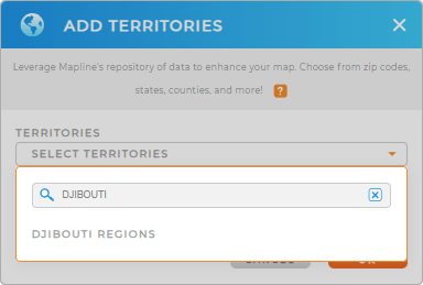
Let’s add a new territory from Mapline’s repository to start taking control of your territory management and drive smarter, faster growth for your brand. Type DJIBOUTI in the search bar to add DJIBOUTI REGIONS to your map in seconds!
You’re halfway there. Let’s quickly turn you over to the last step.


Pro Tip: With Mapline’s territory repository, mapping international locations is a breeze! Effortlessly create custom maps with country boundaries from around the world, including Djibouti regions, to gain valuable insights for international business expansion.
CHOOSE REGION COLORS
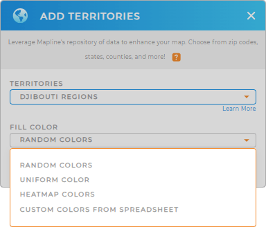
The final step in optimizing your territory management is to apply colors to your territories. With colored regions, you can analyze key factors that impact your business in half the time.
Choose the color styles that help you easily identify trends, challenges, and opportunities at a glance. You can apply heat map colors for a deeper dive into data insights, revealing patterns and density around critical points. If you’ve already defined your territories, you can seamlessly import your custom territories, adding another layer of precision to your analysis.
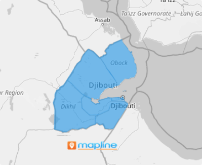
Lastly, hit OK. Now, there’s your map of Djibouti regions as a focal point of your territory analysis and management!

GET NEW TERRITORY INSIGHTS
Stir up even brighter ideas when you leverage these capabilities into your analytics for enhanced territory management:
- Generate territories around your pins for regional competitor analysis
- Apply coverage areas around your stores to see factors affecting your business
- Leverage Mapline data for distance analysis of your competitors to your store locations


