
Mapping Benin Communes for Livelihood Improvement
Planning and Program Implementation Through Commune-Level Mapping
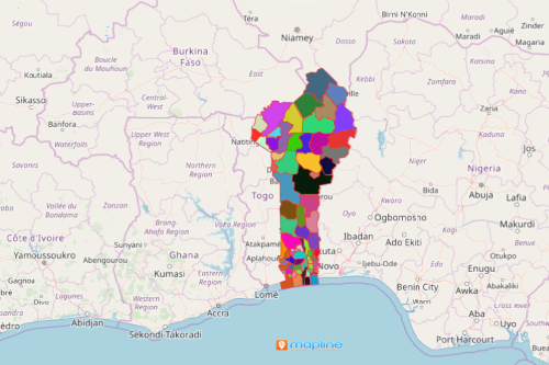
Mapping Benin communes reveals insights that are vital to planning programs for livelihood improvement. Benin, a tropical country in West Africa, is divided into 12 departments which are further divided into 77 communes. These communes are sub-divided into arrondissements and villages or city districts. A careful study of each commune can show significant insights on planning for reducing poverty and improving the lives of rural people.
On a Benin map showing communes, you can overlay different layers of datasets for individual analysis. Then, you can color-code them to show which data layer stands out in each commune. For example, you can assign different colors or images to small-scale farmers, vegetable growers, cotton fields, and rural financial services.
Start Mapping Communes of Benin Now!
It only takes less than a minute to create a map of communes. Then, you can start planning for agricultural development and strategize opportunity programs.
- Create a Mapline account and login.
- Click the orange “Add New Items” button.
- Select “New Map” on the drop down arrow.
- Give your map a name and click “OK.”
- Click the “Add” button from the left sidebar.
- Select the “Territories” option.
- Click “From Mapline’s Repository.”
- From the “Territories” select “Benin Communes.” Use the search bar for quicker results.
- Select how you want your boundaries to be colored in “Fill Color” (Random Colors, Uniform Color, Dynamic heat map colors, or Custom colors from spreadsheet).
- Click “OK.”
Mapping Benin communes is that easy! Mapline also makes it simple to see summary information about the locations inside each commune just by clicking on them! Sign up now to start utilizing powerful mapping tools when planning for agricultural and livelihood programs.