
Understand Economic Causes Through Burkina Faso Map Showing Provinces
Better Economy Management When Mapping Province Boundaries
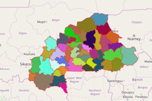
A Burkina Faso map showing provinces is an integral tool for researchers to understand the economy of the country. To understand the root of the problem, they need to see through each individual province. Burkina Faso is a country located in West Africa. There are currently 45 administrative provinces in the country which were further subdivided into 351 departments or communes. Studies conducted on social and economic causes not only increases awareness. More than that, if develops plans for transformative changes. And what better way to do that is by looking at the situation through mapping Burkina Faso provinces.
For instance, you may be conducting research about malnutrition cases. Heat maps are one of the most useful tools that produce immense impact. It provides clear visibility of areas that are deeply affected by malnutrition. The insights taken from the data visualization contributes significantly to creating programs that are geared toward increasing food security.
Mapping for Socio-Economic Analysis
Mapping provinces of Burkina Faso takes a few seconds only. Once generated, you can overlay Excel spreadsheet data and start your socio-economic analysis.
- Create a Mapline account and login.
- Click the orange “Add New Items” button.
- Select “New Map” on the drop down arrow.
- Give your map a name and click “OK.”
- Click the “Add” button from the left sidebar.
- Select the “Territories” option.
- Click “From Mapline’s Repository.”
- From the “Territories” select “Burkina Faso Provinces.” Use the search bar for quicker results.
- Select how you want your boundaries to be colored in “Fill Color” (Random Colors, Uniform Color, Dynamic heat map colors, or Custom colors from spreadsheet).
- Click “OK.”
That’s how easy it is to create a Burkina Faso map showing provinces! Mapline also makes it simple to see summary information about the locations inside each province just by clicking on them! Sign up now and experience the advantage of using mapping tools for your data-based research.