
Tap Business Growth With The Help of Municipality Map of Cape Verde
Leverage GIS Mapping in Tourism Business
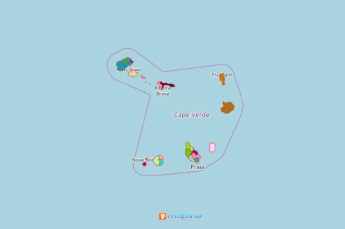
Analyzing locations on a municipality map of Cape Verde will open the doors to business success and innovation. Cape Verde (also known as Cabo Verde) is located in the central Atlantic Ocean. It is divided into 22 municipalities which are further divided into 32 parishes. Among African countries, Cape Verde is considered to be one of the most developed. Tourism plays a key role in its economy. Increase your customer-centric approach as you map in municipality-level
A coverage network tool is usually used to focus on tourism locations and where the customers are. Applying that on a Cape Verde map showing municipalities can answer questions such as where do customers live? How far away are they from a tourist spot? How far do customers need to travel to get there?
Municipality Map Drives Informed Decisions
Simple steps of creating a map of municipalities of Cape Verde will take you to an enjoyable ride of geospatial analysis for tourism business growth:
- Create a Mapline account and login.
- Click the orange “New” button.
- Select “New Map” on the drop down arrow.
- Give your map a name and click “OK.”
- Click the “Add” button from the left sidebar.
- Select the “Territories” option.
- Click “From Mapline’s Repository.”
- From the “Territories” select “Cape Verde Municipalities.” Use the search bar for quicker results.
- Select how you want your boundaries to be colored in “Fill Color” (Random Colors, Uniform Color, Dynamic heat map colors, or Custom colors from spreadsheet).
- Click “OK.”
That’s how easy it is to create a municipality map of Cape Verde! Once you have your map, you can create a map of Excel spreadsheet locations to overlay on top. Mapline also makes it simple to see summary information about the locations inside each province just by clicking on them. Sign up now and gain access to a lot more powerful tools that can help you tap business growth!